
High Atlas Mountain: the Living Culture of Morocco’s Great Mountain Range
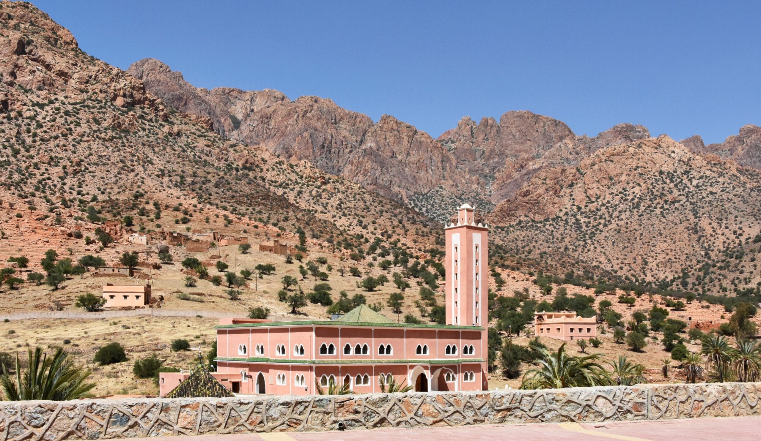
Introduction: Where Mountains Become a Civilization
There are mountains that dominate a landscape, and there are mountains that shape an entire civilization.
For a broader overview of the entire Atlas mountain system, see our comprehensive guide to the Atlas Mountains.
The High Atlas Mountain belongs to the second category.
Rising dramatically across central Morocco, the High Atlas is far more than a spectacular chain of peaks separating different ecological zones. It is a geographical system, a climatic barrier, a reservoir of water, an archaeological landscape, a network of valleys and passes, and—most importantly—a homeland in which Amazigh communities have developed sophisticated ways of living with altitude, scarcity, seasonal change, and difficult terrain.
From the high summits surrounding Jbel Toubkal to the cultivated valleys of the Ourika, Ouirgane, Rheraya, Aït Bouguemez, Imilchil, and other mountain basins, the High Atlas contains an extraordinary diversity of environments. Snowfields and alpine pastures occur only a relatively short distance from semi-arid valleys where agriculture depends on carefully managed streams and springs. A village may sit beneath cliffs exceeding 3,000 meters while its terraces produce wheat, barley, walnuts, apples, vegetables, and other crops. A shepherd may move livestock through high summer pastures according to rules whose origins reach deeply into local customary institutions.
This apparent contradiction—harsh environment combined with sophisticated human adaptation—is one of the defining characteristics of the High Atlas.
Scientific research increasingly demonstrates that the mountain’s ecological and social systems cannot be understood separately. Research on High Atlas land rights, for example, documents the importance of agdal, customary systems through which communities regulate access to natural resources and protect collective ecological interests.
At the same time, archaeological research has revealed that the High Atlas is not simply a medieval or modern cultural landscape. Rock engravings, prehistoric settlements, pastoral routes, and material remains demonstrate that people interacted with these mountains for thousands of years. Research around Oukaïmeden, for example, has combined archaeology, palaeoenvironmental research, geology, and landscape studies to examine the relationship between prehistoric communities and mountain environments.
The High Atlas therefore deserves to be understood on several levels simultaneously.
It is a geological structure created through immense tectonic processes. It is a climatic and hydrological system. It is a biological refuge containing highly threatened endemic flora. It is an archaeological archive. It is a homeland of Amazigh communities. And it remains a living landscape whose traditions are adapting to drought, migration, tourism, changing agriculture, and modern infrastructure.
This article focuses only on the High Atlas Mountain, deliberately separating it from broad discussions of the entire Atlas mountain system. The objective is to create a dedicated geographical, historical, anthropological, and cultural cluster article that can complement a broader Atlas Mountains pillar page without simply repeating it.
Table of Contents
What Is the High Atlas Mountain?
The expression “High Atlas Mountain” is commonly used in English, although High Atlas Mountains is more precise because the term refers to an extensive mountain range rather than a single peak.
The High Atlas forms the highest and most dramatic portion of Morocco’s Atlas system. Its main axis extends broadly from the Atlantic side of Morocco toward the country’s eastern frontier, with the range displaying considerable variation in geology, elevation, climate, vegetation, and human settlement.
Scientific studies describe the High Atlas as an intracontinental mountain belt. Its modern structure is strongly connected to the convergence between Africa and Europe and to the tectonic reactivation of older geological structures. Research on the chain has shown that its present form reflects the inversion and deformation of older Mesozoic basins and structures rather than the simple creation of a young mountain range from scratch.
This distinction matters.
The rocks exposed in the High Atlas record geological events much older than the mountains’ present topography. Paleozoic basement rocks, Mesozoic sedimentary formations, volcanic rocks, faults, folds, and younger erosional surfaces collectively preserve a geological history extending across hundreds of millions of years.
The spectacular mountains visible today are therefore the latest expression of a much older geological story.
The Geography of High Atlas Mountain
The General Orientation of the Range
The High Atlas follows a broadly ENE–WSW to E–W structural orientation, although its geometry changes significantly from west to east.
Studies of the mountain system commonly describe the High Atlas as approximately 800 kilometers long, with a width that can reach several tens of kilometers depending on how its boundaries are defined. A hydrological study of the range describes it as approximately 60 km wide and 800 km long, while other geographical analyses use broader boundaries depending on whether peripheral plateaus and piedmont zones are included.
This is an important geographical qualification: there is no single universally applicable line that defines the High Atlas at every location.
Mountain ranges are not administrative objects. Their boundaries depend partly on geology, topography, drainage, and geographical convention.
Where Does the High Atlas Mountain Begin and End?
One of the most common questions asked by travelers is:
Where are the borders of the High Atlas Mountain?
Broadly speaking, the High Atlas extends from the Atlantic-facing western part of Morocco toward the Moroccan–Algerian frontier.
Its northern side descends toward major plains and plateaus, including the Marrakech–Haouz region in the west and other elevated basins and plateaus farther east.
Its southern side transitions toward the more arid landscapes associated with the Ouarzazate, Draa, Dadès, and other southern regions, while farther south lies the Anti-Atlas system.
The western High Atlas has a particularly dramatic relationship with the Atlantic-influenced environment, whereas the central and eastern portions become increasingly continental and arid.
Research on High Atlas vegetation identifies the range as extending from Morocco’s Atlantic coast to the Algerian border and reaching from relatively low elevations to the summit of Jbel Toubkal at 4,167 meters.
In simple geographical terms:
North: Moroccan plains, plateaus, and basins
South: High Atlas piedmonts, valleys, and transition toward the Anti-Atlas and Saharan-influenced regions
West: Atlantic-influenced mountain environments
East: Continuing High Atlas structures toward the Moroccan–Algerian frontier
The exact boundary should therefore be understood as a geographical transition rather than a perfectly fixed administrative border.
The Highest Point: Jbel Toubkal
No discussion of the High Atlas can begin without its most famous summit.
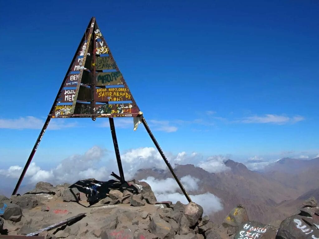
Jbel Toubkal: 4,167 Meters Above Sea Level
At 4,167 meters, Jbel Toubkal is the highest mountain in Morocco, the High Atlas, and North Africa. Scientific literature on the High Atlas consistently identifies the Toubkal massif as the highest part of the range.
But Toubkal’s importance goes beyond its elevation.
Its enormous prominence creates a powerful visual presence over the surrounding valleys. The massif is composed largely of volcanic rocks and has been deeply sculpted by erosion, producing steep slopes, alpine ridges, and narrow valleys.
The mountain is located within Toubkal National Park, an area established to protect important mountain ecosystems while accommodating tourism and local communities.
For modern travelers, the standard approach to Toubkal begins around the village of Imlil and continues through the Mizane Valley toward mountain refuges and the summit route.
But reducing Toubkal to a hiking destination misses something fundamental.
For surrounding communities, mountains are not simply recreational spaces.
They are pasture.
They are water sources.
They are agricultural territories.
They are places of memory.
They are routes between communities.
They are sacred or culturally meaningful landscapes.
And they are part of the everyday geographical knowledge transmitted between generations.
The Major Geographic Divisions of the High Atlas Mountain
The High Atlas should not be imagined as one homogeneous mountain wall.
Its western, central, and eastern sectors display substantial differences.
The Western High Atlas Mountain
The western High Atlas includes the mountain landscapes south of Marrakech and toward the Atlantic-facing regions.
Important areas include:
- Ourika Valley
- Oukaimeden
- Imlil and the Toubkal massif
- Ouirgane
- Asni
- Rheraya
- Aït Mizane
- Toubkal National Park
This region is particularly important for mountain tourism because of its proximity to Marrakech.
It is also culturally significant for the persistence of Amazigh communities and mountain agriculture.
The Central High Atlas
The Central High Atlas contains some of the most spectacular geological formations in Morocco.
It includes landscapes around:
- M’Goun
- Aït Bouguemez
- Imilchil
- Dadès headwaters
- Mgoun massif
- Central mountain plateaus
The Central High Atlas demonstrates the relationship between geological structure and human settlement particularly clearly.
Deep valleys concentrate water and agriculture, while high plateaus provide seasonal pasture.
The Eastern High Atlas
Farther east, the mountain landscape becomes increasingly continental and semi-arid.
The valleys are often narrower, the vegetation more restricted, and the relationship between water and settlement even more pronounced.
Communities have historically depended on:
- springs,
- snowmelt,
- seasonal streams,
- irrigation channels,
- pastoral mobility,
- and oasis agriculture.
The eastern High Atlas therefore provides an especially useful case study in human adaptation to environmental scarcity.
How Was the High Atlas Mountain Formed?
The Geological Story Beneath the Mountains
The spectacular scenery of the High Atlas is ultimately a product of deep geological time.
The mountain range is not simply a pile of rocks pushed upward during one geological event.
Instead, its structure reflects several major phases.
Ancient Basement
Some rocks exposed within and around the High Atlas belong to ancient geological formations that predate the modern mountain system by hundreds of millions of years.
Mesozoic Extension
During the Mesozoic Era, parts of the region underwent extension associated with the development of rift basins.
These basins accumulated thick sequences of sediments.
Cenozoic Compression
Later, convergence between Africa and Europe produced compression and tectonic inversion.
Older extensional structures were reactivated or incorporated into new deformation.
This process contributed to the folding, faulting, uplift, and elevation that characterize the modern High Atlas.
Research on the Marrakech High Atlas describes the range as an intracontinental orogen whose present structure reflects Cenozoic shortening and thermal processes acting upon older geological inheritance.
Other structural research emphasizes the role of older faults inherited from earlier tectonic episodes, demonstrating why geological history cannot be separated from the present architecture of the mountains.
The High Atlas Mountain as a Geological Archive
One of the most fascinating characteristics of the High Atlas is the exceptional exposure of geological formations.
A traveler walking through the mountains may encounter:
- folded sedimentary layers,
- limestone cliffs,
- sandstone formations,
- volcanic rocks,
- metamorphic rocks,
- fault zones,
- fossil-bearing strata,
- ancient lake deposits,
- deeply eroded valleys.
The landscape can therefore be read almost like a geological book.
The central High Atlas is particularly important to geologists because ancient rift-related structures and later deformation can be observed relatively clearly.
Research has documented both Mesozoic magmatism and older volcanic activity within the High Atlas, demonstrating that the region has experienced repeated episodes of tectonic and magmatic transformation.
Climate of the High Atlas Mountain
A Mountain Climate of Extreme Contrasts
The High Atlas creates dramatic climatic contrasts over relatively short distances.
Elevation is one of the most important variables.
At low elevations, temperatures may be warm and landscapes semi-arid.
Higher elevations experience:
- colder winters,
- snowfall,
- freezing temperatures,
- shorter growing seasons,
- alpine conditions.
Research on High Atlas biodiversity describes two broad climatic influences: a more oceanic character in some western sectors and a more continental semi-arid regime in parts of the central and eastern range.
This climatic diversity helps explain why the High Atlas supports such different ecosystems.
Snow and Water
Snow is not simply a visual feature of the High Atlas.
It is part of the mountain’s hydrological system.
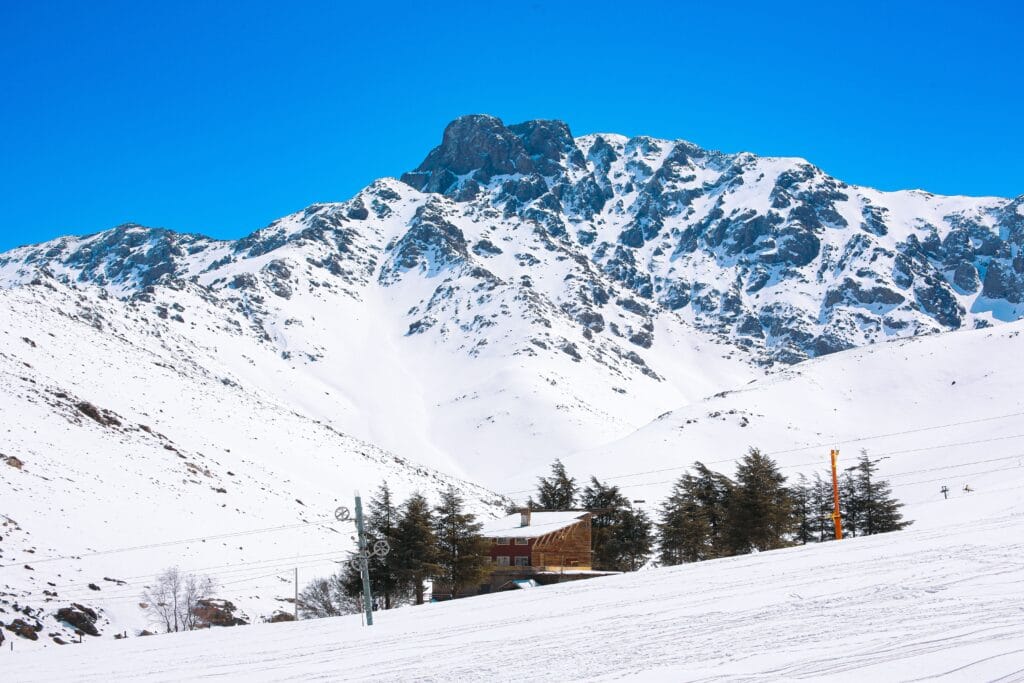
Snow accumulated at high elevations can contribute to spring and summer runoff, although the timing and quantity of meltwater are highly variable.
This makes mountain hydrology essential to agriculture in downstream valleys.
The relationship can be summarized as:
snow and precipitation → mountain runoff → streams and groundwater → irrigation → crops → settlements
This chain has supported mountain communities for centuries.
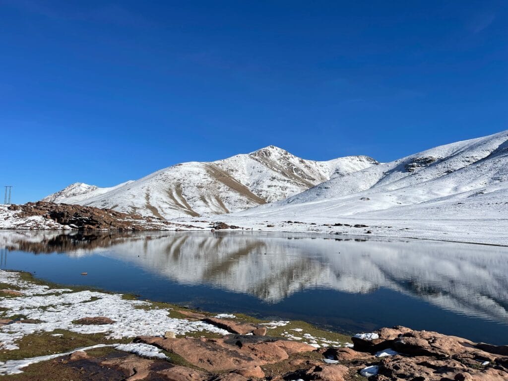
The High Atlas as Morocco’s Water Tower
One of the most important geographical functions of the High Atlas is its role in water production and storage.
Research indicates that the mountains provide a major share of irrigation water supporting surrounding plains and agricultural regions. One remote-sensing study estimates that the High Atlas contributes approximately 85% of irrigation water for major surrounding plains, including the Haouz, Souss, Draa, and Dadès regions.
This makes the High Atlas important far beyond the communities living inside the mountains.
Water generated or stored in mountain environments supports people hundreds of kilometers away.
In other words:
The High Atlas is not geographically isolated from Morocco’s plains. It is hydrologically connected to them.
Rivers, Valleys, and Mountain Agriculture
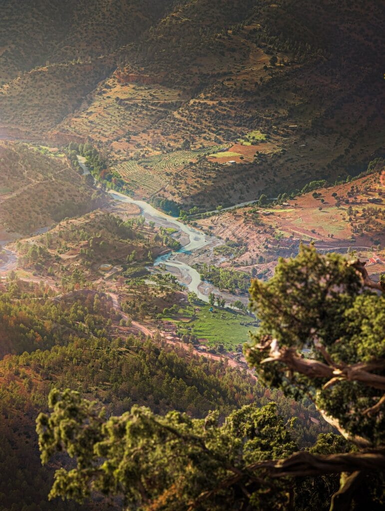
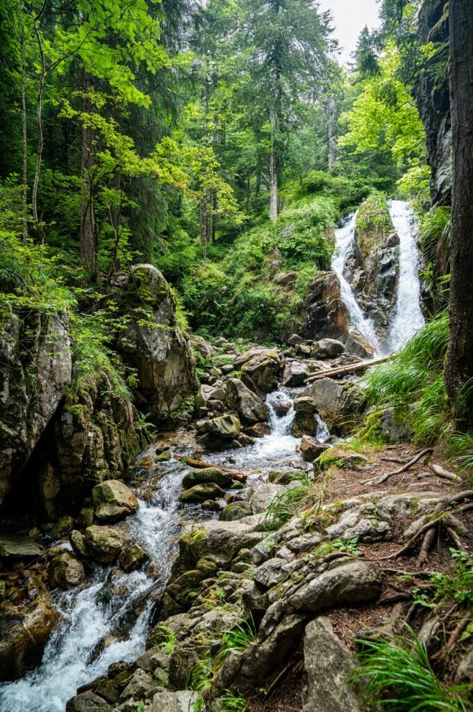
The High Atlas is deeply dissected by valleys.
These valleys are not simply geological scars.
They are the locations where human settlement becomes possible.
Water concentrates there.
Soils accumulate there.
Transportation routes follow them.
Agricultural terraces occupy their slopes.
Villages cluster along their edges.
As a result, the valley becomes the fundamental geographical unit of much High Atlas life.
Traditional Water Management in the High Atlas Mountain
Water as a Social Institution
In environments where water is scarce, water cannot be treated merely as a commodity.
It becomes a social institution.
High Atlas communities developed complex systems for allocating, protecting, and maintaining water.
These include:
- irrigation channels,
- springs,
- communal water infrastructure,
- agricultural terraces,
- customary water rights,
- seasonal agreements,
- local institutions.
The importance of customary resource governance is particularly visible in the agdal system.
Recent scholarship on land rights among Amazigh populations in the Moroccan High Atlas describes agdal as a customary institutional framework governing access to natural resources and communal land.
This demonstrates something important about Amazigh environmental knowledge.
Traditional ecological management was not necessarily written in formal environmental legislation.
It could instead be embedded in:
- customary law,
- oral tradition,
- collective memory,
- social obligations,
- seasonal rituals,
- and community institutions.
Agdal: More Than a Protected Area
The word agdal has acquired particular significance in research on Amazigh resource management.
In different contexts, it can refer to protected communal resources or territories whose exploitation is restricted according to locally established rules.
Restrictions may concern:
- grazing,
- cutting trees,
- harvesting plants,
- accessing pastures,
- collecting resources.
The underlying principle is ecological as well as social:
temporary restriction can protect resources for future collective use.
This is particularly important in mountainous environments where ecological recovery can be slow.
The High Atlas case therefore contributes to a much wider discussion about indigenous environmental governance.
It challenges the assumption that sophisticated conservation systems necessarily require modern institutions.
Amazigh Communities of the High Atlas Mountain
A Mountain Homeland
The High Atlas is home to predominantly Amazigh-speaking communities, although linguistic and cultural diversity varies from valley to valley.
The term “Amazigh” is preferable when discussing indigenous identity, while “Berber” remains common in older academic and international literature.
The communities of the High Atlas have developed distinctive cultural forms influenced by:
- altitude,
- valley geography,
- tribal history,
- pastoralism,
- agriculture,
- trade,
- religious institutions,
- migration,
- and interaction with neighboring regions.
Recent research on High Atlas livelihoods emphasizes that Amazigh communities remain strongly connected to agriculture, pastoralism, local ecological knowledge, and changing rural–urban relationships.
Language in the High Atlas Mountain
Tamazight Is Part of the Landscape
Tamazight Language is one of the most important components of High Atlas identity.
Different Amazigh varieties are spoken across the broader mountain system, with Tashelhit (Tachelhit) especially important in the western and southwestern parts, while Central Atlas Tamazight and other varieties occur farther east and north.
It is therefore inaccurate to describe every High Atlas community as speaking exactly the same Amazigh variety.
Mountain geography itself contributes to linguistic diversity.
A valley separated from another by difficult passes may develop:
- distinctive vocabulary,
- pronunciation,
- personal names,
- place names,
- oral traditions,
- poetic forms.
Amazigh Place Names and Mountain Geography
Place names are cultural archives.
Across the High Atlas, names frequently encode relationships with:
- water,
- rocks,
- animals,
- vegetation,
- terrain,
- human settlement,
- movement,
- agriculture.
A mountain name can therefore preserve historical information even when the original meaning becomes less obvious to younger generations.
The linguistic study of High Atlas geography deserves greater attention because toponyms often preserve indigenous geographical classifications that existed before modern maps.
A place name can tell us that a valley was associated with:
- a particular plant,
- a water source,
- a pasture,
- a clan,
- a geological feature,
- or a route.
In this sense, the Amazigh landscape is partly written in Amazigh language.
Traditional High Atlas Mountain Villages
Villages Built Around Geography
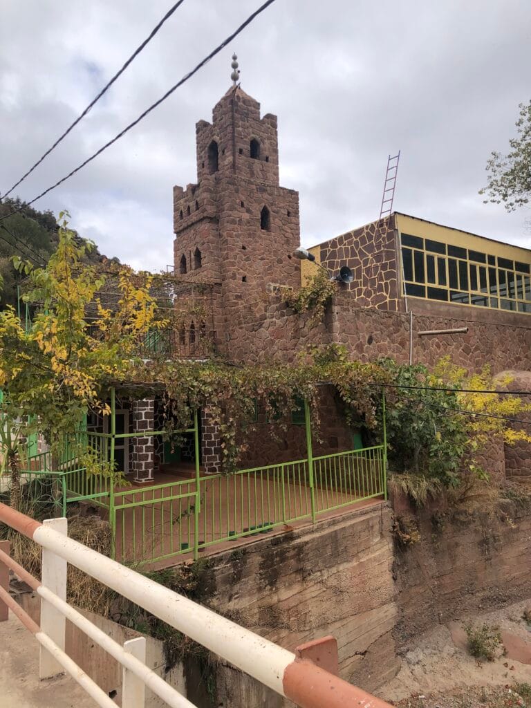
Traditional High Atlas settlements demonstrate how architecture responds to environment.
Villages are frequently located where several resources converge:
- water,
- cultivable land,
- pasture,
- defensible terrain,
- transportation routes.
Architecture varies considerably across the range, but traditional houses often use locally available materials.
Depending on the locality, these can include:
- stone,
- earth,
- mud brick,
- rammed earth,
- timber.
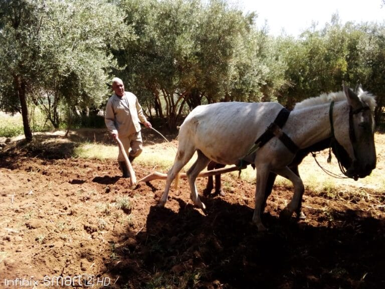
Terraced Agriculture
One of the most remarkable features of High Atlas landscapes is terracing.
Where slopes are steep, flat agricultural land is scarce.
Farmers therefore reshape the terrain.
Stone walls retain soil.
Terraces reduce erosion.
Water can be directed through fields.
Cultivation becomes possible on slopes that would otherwise be difficult to farm.
The result is a landscape in which geology and human labor become almost inseparable.
A mountain slope that initially appears “natural” may actually contain centuries of human modification.
What Do High Atlas Communities Grow?
Agriculture varies according to altitude and valley.
Common crops and products include:
- wheat,
- barley,
- maize,
- vegetables,
- apples,
- walnuts,
- almonds,
- olives,
- fruit trees,
- medicinal plants.
At higher elevations, the agricultural calendar becomes shorter.
Pastoralism therefore complements cultivation.
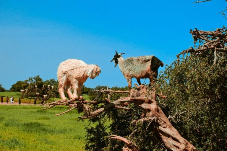
Livestock may include:
- sheep,
- goats,
- cattle.
The combination of agriculture and pastoralism creates an integrated mountain economy.
The Cold-Oasis Agricultural System
The High Atlas Mountain contains agricultural systems that demonstrate remarkable adaptation to cold mountain environments.
The FAO recognizes the Mountains Oases System in the Atlas Mountains of Morocco as a Globally Important Agricultural Heritage System.
According to FAO, these systems integrate vegetables, cereals, fruits, pasture, livestock, crop rotation, agroforestry, and sophisticated water management under difficult climatic conditions.
This is significant because the word “oasis” is often associated exclusively with deserts.
The High Atlas demonstrates another form of oasis:
a cold mountain oasis.
The concept is important because it reveals that oasis agriculture is fundamentally about managing scarce resources in difficult environments, not simply about palm trees in deserts.
Pastoralism and Seasonal Mobility
Pastoralism remains an important element of High Atlas cultural landscapes.
Livestock movement may follow seasonal availability of pasture and water.
High-elevation pastures can become productive during warmer months after winter snow recedes.
This produces a seasonal rhythm:
winter settlement → spring transition → summer high pastures → autumn descent
The exact pattern differs by community and environment.
Archaeological research in the Oukaïmeden Valley is especially interesting because modern shepherds continue to use high pastures, allowing researchers to compare contemporary mobility with evidence from earlier periods.
Oukaïmeden: Archaeology in a Living Pastoral Landscape
Oukaïmeden is one of the most important archaeological landscapes in the High Atlas.
Its significance comes from the extraordinary concentration of prehistoric rock engravings.
Research projects have documented:
- animal engravings,
- anthropomorphic figures,
- geometric motifs,
- prehistoric pottery,
- lithic materials,
- burial structures,
- settlement evidence.
The archaeological landscape cannot be separated from the modern use of the valley.
Modern shepherds continue to use high pastures, while archaeological research investigates how earlier communities interacted with the same landscape.
This makes Oukaïmeden an exceptional example of landscape continuity.
The same mountain environment has served different human communities across very long periods.
Rock Art of the High Atlas Mountain
Mountains as an Archaeological Archive
Rock art transforms mountains into historical documents.
Across the High Atlas, engravings can depict animals, weapons, humans, geometric forms, and other motifs.
Researchers have documented more than a thousand figures in difficult-to-access locations at elevations exceeding 2,000 meters in some areas.
This raises fascinating questions.
Why were these locations selected?
Who created the engravings?
What did the images mean?
Were they associated with ritual practices?
Were they territorial markers?
Were they connected with pastoral movement?
Were some images linked to seasonal calendars?
Archaeology does not always provide definitive answers.
And this uncertainty is important.
A responsible academic interpretation distinguishes between evidence and hypothesis.
The Ram Motif and Mountain Landscapes
Recent research has provided new perspectives on animal imagery in High Atlas Mountain rock art.
A 2026 study in the Journal of Anthropological Archaeology examined ram engravings across High Atlas landscapes using spatial modelling and motif analysis. The research found that many engravings cluster around springs, drainage lines, passes, and landscape divides, encouraging interpretations that emphasize relationships between rock art, water, movement, and mountain geography.
This does not mean every engraving had a single religious meaning.
Instead, it suggests that rock art should be studied in relation to where it occurs, not only what it depicts.
That methodological shift is crucial.
A mountain engraving is not simply an isolated picture carved into stone.
It is part of a landscape.
Ancient Rhinoceros Images in the High Atlas Mountain
Another remarkable archaeological discovery concerns rhinoceros engravings.
Research published in L’Anthropologie documented rhinoceros representations in the western High Atlas, expanding the known distribution of such imagery within Moroccan rock art.
These images are significant because they provide evidence for ecological conditions and human encounters with large fauna during periods when the environments of North Africa differed substantially from those of today.
The High Atlas therefore preserves not only human history but evidence of changing relationships between people and animals.
Mountains as Memory
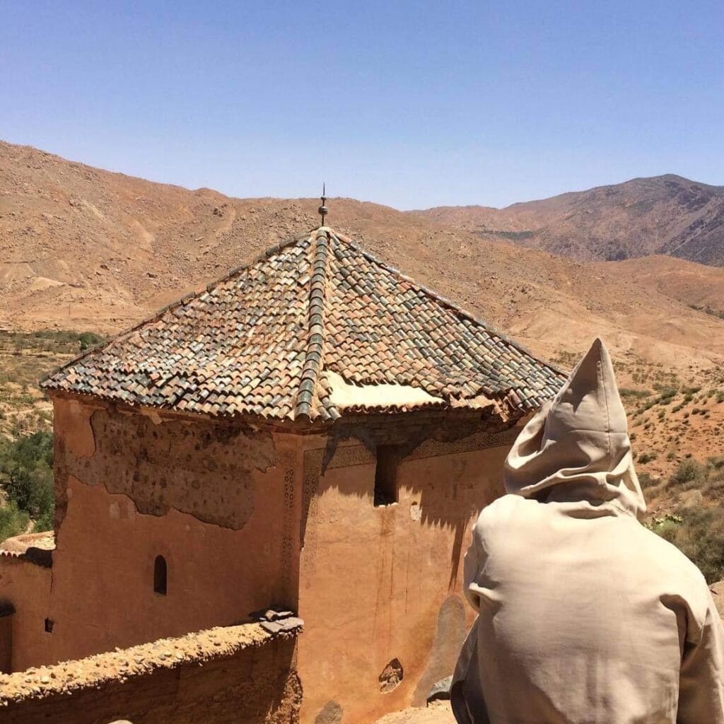
For modern Amazigh communities, mountains are also repositories of collective memory.
A particular valley may be remembered through:
- ancestral stories,
- tribal histories,
- saints’ traditions,
- migration narratives,
- battles,
- marriages,
- agricultural events,
- disasters,
- religious journeys.
Oral history therefore complements archaeology.
A landscape can contain information that does not appear in written archives.
Oral Tradition in the High Atlas Mountain
Stories That Travel Through Valleys
Amazigh oral culture has historically transmitted knowledge through:
- poetry,
- songs,
- proverbs,
- storytelling,
- genealogies,
- ceremonial speech,
- musical performance.
In mountain societies where literacy was historically uneven, oral transmission was an essential mechanism for preserving knowledge.
This knowledge could concern:
- agriculture,
- weather,
- animals,
- social relations,
- morality,
- history,
- geography.
The oral tradition should therefore not be treated simply as entertainment.
It can function as a social archive.
Music and Dance in the High Atlas
Music is one of the most visible forms of Amazigh cultural continuity, such as Ahwach, a collective dance and singing.
Different regions of the High Atlas have distinctive musical repertoires.
Performance may involve:
- collective singing,
- drums,
- frame percussion,
- rhythmic clapping,
- poetry,
- dance.
In the western High Atlas, Taskiwin, a martial dance tradition, has received international heritage recognition. UNESCO lists Taskiwin among Morocco’s elements on the Urgent Safeguarding List.
Its significance demonstrates how cultural traditions can encode historical ideas of masculinity, community, performance, and social identity.
Amazigh Hospitality in the High Atlas Mountain
Hospitality as Social Ethics
Visitors to High Atlas villages frequently encounter hospitality expressed through:
- mint tea,
- bread,
- olive oil,
- Argan oil,
- Tajine
- nuts,
- dates,
- shared meals,
- conversation.
But reducing hospitality to a tourism attraction would be misleading.
Hospitality has deeper social foundations.
In mountain environments where travelers historically depended on local communities for:
- shelter,
- water,
- food,
- navigation,
- protection,
hospitality became intertwined with social ethics and reciprocal relationships.
Today, tourism has transformed some forms of hospitality into commercial experiences, but household hospitality remains important in many communities.
Women and the High Atlas Economy
Women play crucial roles in mountain livelihoods.
Their work may include:
- agriculture,
- food processing,
- livestock care,
- weaving,
- household production,
- gathering plants,
- childcare,
- cultural transmission.
Modern cooperatives have created new opportunities for women to commercialize traditional products.
However, an academic treatment should avoid presenting cooperatives as a simple story of “empowerment.”
Their effects vary according to:
- market access,
- education,
- transport,
- household responsibilities,
- tourism,
- access to finance,
- local institutions.
The transformation of women’s economic roles is therefore part of a much broader restructuring of High Atlas rural society.
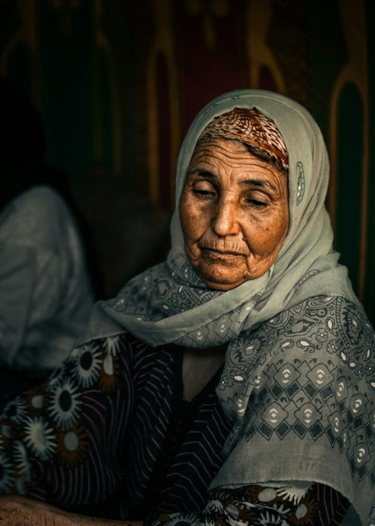
Traditional Crafts of the High Atlas Mountain
Craft traditions differ among valleys and communities.
They can include:
- weaving,
- wool production,
- pottery,
- woodworking,
- leatherwork,
- metalwork,
- basketry.
Crafts often combine economic and symbolic functions.
A woven textile may be useful while simultaneously communicating:
- regional identity,
- aesthetic preferences,
- family knowledge,
- social status,
- ceremonial significance.
The object therefore belongs to both the economy and the cultural sphere.
High Atlas Mountain Architecture and Environmental Adaptation
Traditional architecture is one of the clearest expressions of environmental knowledge.
Buildings constructed from earth and stone provide thermal mass.
Thick walls slow heat transfer.
Compact settlements reduce exposure.
Small openings can limit excessive heat loss or solar gain.
Courtyards provide controlled outdoor space.
Locally sourced materials reduce transportation requirements.
These features should not be romanticized as universally “perfectly sustainable.”
Traditional systems had limitations.
Maintenance was essential.
Heavy rainfall could damage earthen structures.
Modern families increasingly demand concrete, electricity, plumbing, roads, and other infrastructure.
The real lesson is therefore not that traditional architecture should simply replace modern construction.
It is that traditional architecture contains locally adapted knowledge that contemporary architects can study.
High Atlas Architecture as Cultural Identity
Buildings also communicate belonging.
A house can reveal:
- local materials,
- regional construction techniques,
- social organization,
- family structure,
- environmental adaptation.
In this sense, architecture is a form of cultural language.
A mountain village can therefore be read through its built environment just as it can through its oral traditions.
The Social Organization of High Atlas Communities
Historically, many Amazigh communities developed forms of social organization based on:
- extended families,
- villages,
- lineages,
- tribal affiliations,
- customary law,
- communal institutions.
These structures were never identical across the entire High Atlas.
The mountain range contains many distinct communities.
It is therefore important to avoid treating “Amazigh society” as one uniform system.
Instead, the High Atlas should be understood as a cultural mosaic.
Customary Law and Community Governance
Before modern state institutions reached every mountain settlement equally, local communities relied heavily on customary practices.
These could regulate:
- land,
- water,
- grazing,
- agricultural calendars,
- communal work,
- conflict resolution.
The agdal system is particularly important because it demonstrates that environmental governance can be embedded within customary social institutions.
Modern law has transformed these arrangements, but customary knowledge has not simply disappeared.
In some places it has been adapted.
In others it has weakened.
In still others it remains influential.
The High Atlas and Religious Life
Islam became deeply integrated into High Atlas societies over many centuries.
Religious life includes:
- mosques,
- Quranic education,
- religious festivals,
- saints’ traditions,
- pilgrimage to local shrines in some communities.
This should not be interpreted as replacing Amazigh culture.
Rather, local communities historically incorporated Islamic religious institutions into existing social and cultural frameworks.
The result is a complex cultural synthesis in which language, local customs, Islamic practice, agricultural calendars, and community identity interact.
Sacred Landscapes
Certain mountains, springs, caves, trees, and other natural features may acquire sacred or culturally significant associations.
Anthropologists study such places as sacred landscapes because their importance is not reducible to physical geography.
A spring may simultaneously be:
- a water source,
- a meeting place,
- an agricultural resource,
- and a site associated with memory or religious tradition.
This layered meaning is essential to understanding High Atlas culture.
The High Atlas Mountain and Historical Trade
Although the mountains can appear isolated, they were never completely cut off from wider economic networks.
Mountain passes connected communities to:
- Marrakech,
- the Sous Valley,
- Ouarzazate,
- the Draa Valley,
- Saharan routes,
- northern Moroccan markets.
Goods moved through mountain corridors.
So did people.
So did ideas.
So did languages.
Mountain isolation therefore needs to be understood comparatively.
The High Atlas could be difficult to cross, but its passes also created connections.
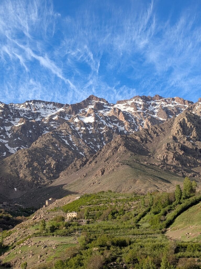
Mountain Passes as Corridors of Civilization
Passes such as:
- Tizi n’Tichka,
- Tizi n’Test,
- Tizi n’Tamatert,
- Tizi n’Ouanoums,
and numerous smaller local passes have played different roles in transportation and pastoral movement.
A pass is more than a high point on a road.
It is a threshold between ecological and cultural zones.
Historically, crossing a pass could mean moving between:
- different valleys,
- different tribes,
- different linguistic communities,
- different agricultural systems,
- different climates.
Tizi n’Tichka and the Northern–Southern Connection
Tizi n’Tichka is one of the best-known passes across the High Atlas.
Today it forms part of the major road connecting Marrakech with Ouarzazate.
Its importance is therefore modern as well as historical.
The road transformed movement through the mountains, increasing:
- tourism,
- trade,
- mobility,
- access to services.
But roads can also accelerate cultural and environmental change.
This illustrates an important principle:
connectivity creates opportunity and disruption simultaneously.
Tourism and the High Atlas
Tourism has become one of the most visible economic transformations in the High Atlas.
Visitors come for:
- trekking,
- mountaineering,
- village tourism,
- photography,
- food,
- cultural experiences,
- skiing,
- landscapes,
- biodiversity.
The proximity of Marrakech gives the western High Atlas a particularly strong tourism economy.
But tourism is unevenly distributed.
Some valleys receive large numbers of visitors.
Others remain relatively remote.
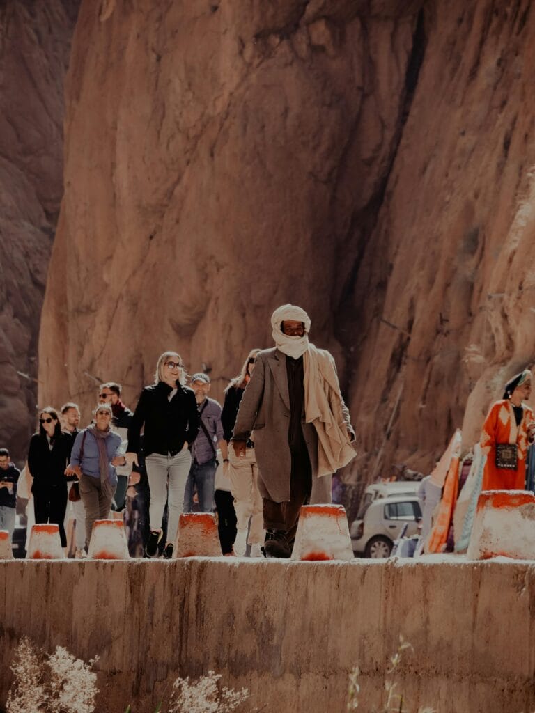
Hiking in the High Atlas
Why the High Atlas Attracts Hikers
The range offers extraordinary variation in trekking environments.
A single journey can pass through:
- irrigated valleys,
- walnut groves,
- terraced farms,
- juniper landscapes,
- alpine terrain,
- rocky summits,
- snowfields.
The High Atlas is therefore suitable for different levels of trekking.
Toubkal Trekking
The ascent of Jbel Toubkal is the best-known High Atlas trek.
The classic route generally begins near Imlil and progresses through the Mizane Valley.
However, altitude should never be underestimated.
At more than 4,000 meters, the body experiences significantly lower atmospheric pressure and reduced oxygen availability.
A successful ascent therefore depends not simply on physical strength but on:
- acclimatization,
- pacing,
- hydration,
- weather awareness,
- appropriate equipment,
- experienced guidance.
Beyond Toubkal: The High Atlas Mountain Is Much Larger
One of the most important points for visitors is that Toubkal does not represent the entire High Atlas.
The range contains numerous other destinations.
These include:
- M’Goun massif,
- Aït Bouguemez,
- Oukaïmeden,
- Ourika,
- Imilchil,
- Mgoun valleys,
- central High Atlas plateaus,
- eastern mountain valleys.
Travelers who only visit Toubkal experience one part of a much larger geographical and cultural system.
High Atlas Mountain Biodiversity
A Mountain Refuge for Rare Species
The High Atlas contains important biodiversity because elevation creates multiple ecological zones.
Species distributions change with:
- altitude,
- slope orientation,
- rainfall,
- soil,
- temperature,
- human land use.
Recent scientific assessment of strict High Atlas endemic vascular flora found extremely high conservation concern: among assessed endemic species, 33% were classified as Critically Endangered, 62% Endangered, 4% Vulnerable, and 1% Near Threatened.
These figures demonstrate that biodiversity conservation in the High Atlas is not an abstract environmental issue.
It is urgent.
Why High Atlas Plants Are Vulnerable
Researchers identify several major pressures:
- overgrazing,
- drought,
- climate change,
- habitat fragmentation,
- deforestation,
- unsustainable plant collection,
- tourism pressure,
- agricultural intensification,
- urbanization,
- infrastructure development.
The vulnerability of endemic plants is particularly serious because species with very restricted geographical distributions have fewer places to escape environmental change.
Climate Change in the High Atlas
Climate change represents one of the greatest long-term challenges facing the region.
The consequences include:
- changing precipitation,
- prolonged drought,
- reduced water availability,
- changing snow patterns,
- agricultural stress,
- pasture degradation,
- increased pressure on households.
Research on the Ourika watershed has documented severe drought conditions and declining water availability affecting both agriculture and urban water systems.
Other research examining High Atlas rural livelihoods reports that water shortages are already influencing crop choices and livestock numbers in Amazigh villages.
The Future of Mountain Agriculture
Traditional agriculture is not disappearing everywhere, but it is changing.
Young people increasingly seek opportunities outside rural villages.
Migration can reduce the available agricultural labor force.
Households may simplify crop systems.
Some terraces may become less intensively cultivated.
At the same time, new opportunities emerge through:
- tourism,
- cooperatives,
- digital commerce,
- organic agriculture,
- specialty foods,
- cultural tourism.
A recent study of Tizi N’Oucheg found that rural–urban transformation is reshaping traditional oasis agriculture that had historically supported substantial food and livestock self-sufficiency.
Migration and the Changing Mountain Village
Migration is one of the most important forces transforming High Atlas communities.
Young residents may move toward:
- Marrakech,
- Agadir,
- Casablanca,
- Rabat,
- Europe,
- Gulf countries,
- other urban centers.
Migration can reduce local population pressure.
But it can also create:
- aging rural populations,
- abandoned fields,
- weakened transmission of agricultural knowledge,
- changing family structures.
At the same time, migrants often send money home and finance:
- new houses,
- irrigation infrastructure,
- education,
- vehicles,
- agricultural improvements.
Migration therefore produces both continuity and transformation.
Traditional Knowledge in the Modern High Atlas
One of the most important questions for the future is whether traditional knowledge can adapt without disappearing.
Traditional knowledge includes:
- reading weather patterns,
- identifying medicinal plants,
- managing water,
- predicting seasonal changes,
- selecting seeds,
- breeding livestock,
- maintaining terraces,
- navigating mountain routes.
Much of this knowledge is experiential.
It is learned through participation rather than textbooks.
When younger generations leave rural communities, some of this knowledge becomes vulnerable.
The High Atlas as a Living Cultural Landscape
A cultural landscape is not simply a place containing monuments.
It is a place where:
environment + people + history + livelihood + memory
interact continuously.
The High Atlas is an exceptional example.
Its cultural value comes not only from ancient ruins or spectacular mountains but from living relationships between communities and their environment.
A terraced field is simultaneously:
- agriculture,
- architecture,
- hydrology,
- ecology,
- family labor,
- inheritance,
- memory.
That is why protecting the High Atlas requires more than protecting individual monuments.
The High Atlas After the 2023 Earthquake
The September 2023 Al Haouz earthquake brought international attention to the vulnerability of mountain communities.
The disaster affected numerous settlements across the High Atlas, particularly in the Al Haouz Province and surrounding mountain areas.
Its consequences were not limited to buildings.
Communities faced disruption to:
- homes,
- roads,
- schools,
- livelihoods,
- water systems,
- agricultural infrastructure,
- cultural heritage.
The earthquake also exposed the vulnerability of traditional earthen architecture when structures are poorly maintained or when reconstruction ignores local geological and architectural conditions.
At the same time, it demonstrated the strength of community solidarity.
Local residents, civil society groups, diaspora communities, and state institutions participated in relief and reconstruction efforts.
Heritage Reconstruction After Disaster
Reconstruction raises a difficult question:
Should traditional villages be rebuilt exactly as they were?
There is no simple answer.
Rebuilding purely with modern concrete may improve certain aspects of structural resistance but can undermine:
- visual identity,
- thermal performance,
- local craftsmanship,
- historical character.
Conversely, rebuilding traditional earthen structures without incorporating modern seismic engineering may reproduce vulnerabilities.
The most promising approach is therefore often heritage-sensitive modernization:
traditional materials and spatial knowledge combined with improved structural engineering.
The High Atlas and Modern Amazigh Identity
The High Atlas occupies a central place in contemporary Amazigh identity.
Language revitalization, cultural associations, artistic production, music, literature, and heritage initiatives have increased public attention to Amazigh history.
The mountain is frequently represented as:
- homeland,
- guardian of memory,
- source of language,
- symbol of endurance.
But academic writing should distinguish symbolic interpretation from historical fact.
The High Atlas did not “protect Amazigh culture” through isolation alone.
Amazigh culture survived through active human processes:
- family transmission,
- language,
- agriculture,
- community institutions,
- oral tradition,
- marriage networks,
- religious life,
- mobility,
- adaptation.
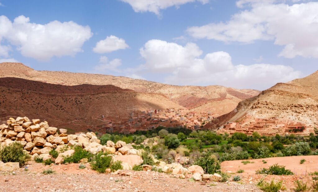
Is the High Atlas a “Guardian of Amazigh Culture”?
The phrase “High Atlas as a guardian of Amazigh culture” is powerful for cultural storytelling, but it requires qualification.
The mountains certainly contributed to the persistence of distinctive communities by shaping settlement patterns and limiting some forms of external penetration.
However, mountains do not preserve culture automatically.
People preserve culture.
The High Atlas provided the geographical setting within which communities could maintain and transform:
- Amazigh languages,
- customs,
- agricultural practices,
- oral traditions,
- social institutions,
- artistic forms.
Therefore, the High Atlas is better understood as a cultural environment and historical homeland rather than a passive guardian.
High Atlas Traditions: Continuity and Change
Traditions are often described as if they remain unchanged.
That is rarely historically accurate.
High Atlas traditions have always evolved.
Agricultural calendars changed.
Markets changed.
Transportation changed.
Religious practices changed.
Clothing changed.
Architecture changed.
Languages borrowed vocabulary.
Music absorbed new influences.
The important question is therefore not:
“Is this tradition ancient?”
but:
“How has this tradition survived by adapting?”
That question produces a much richer understanding of Amazigh culture.
Traditional Festivals and Seasonal Life
Seasonal celebrations remain important in many Moroccan mountain communities.
Depending on the region, traditions may relate to:
- agricultural cycles,
- harvests,
- religious calendars,
- marriages,
- pastoral movement,
- local saints,
- communal events.
Such festivals can reinforce social networks.
They also create opportunities for younger generations to encounter cultural practices that might otherwise become disconnected from everyday life.
Food as High Atlas Heritage
Mountain cuisine is shaped by geography.
Historically, communities relied heavily on what could be produced locally.
This encouraged:
- cereals,
- legumes,
- dairy,
- olives,
- walnuts,
- almonds,
- seasonal vegetables,
- dried fruits,
- preserved foods.
Food preservation is especially important where winters can limit fresh production.
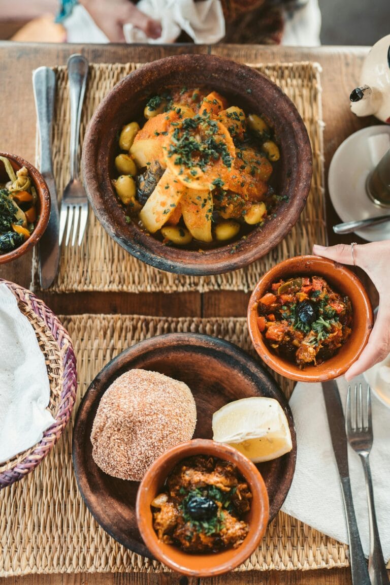
Bread, couscous, tagines, soups, and dairy products therefore reflect not only taste but environmental adaptation.
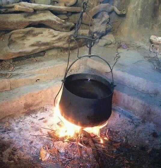
Tea and Hospitality
Mint tea has become one of the most recognizable symbols of Moroccan hospitality.
In the High Atlas, tea may accompany:
- welcoming guests,
- negotiations,
- family conversations,
- market visits,
- travel,
- social gatherings.
The ritual of preparing and serving tea creates time for interaction.
This is important in a mountain culture where relationships are often central to survival.
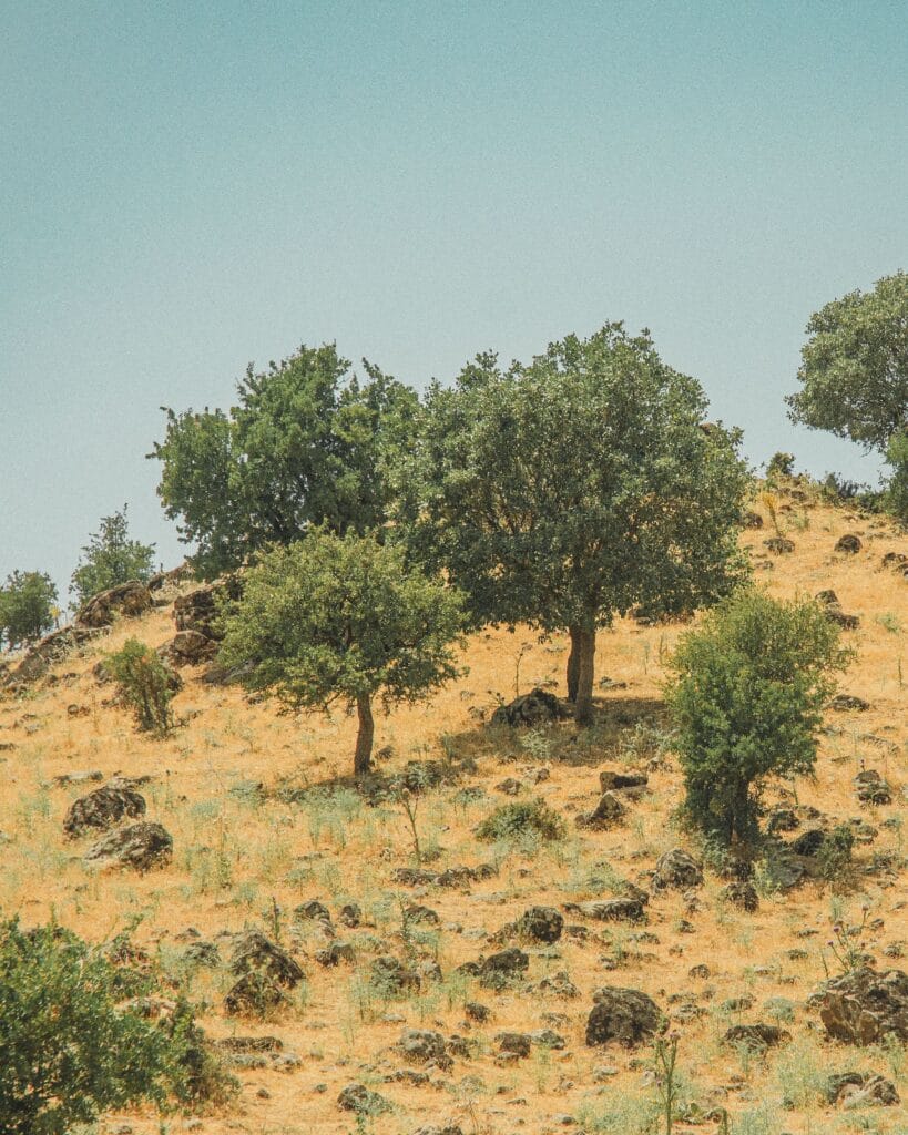
The High Atlas as a Classroom for Anthropology
The High Atlas is particularly valuable to anthropologists because several major themes intersect here:
Environment and society
How do communities adapt to water scarcity?
Kinship
How are families and lineages organized?
Property
Who controls land and water?
Gender
How are labor and economic responsibilities distributed?
Migration
How does urbanization transform villages?
Identity
How is Amazigh identity reproduced?
Heritage
What happens when traditional practices become tourist attractions?
The High Atlas is therefore not simply a travel destination.
It is a major field for understanding human adaptation.
The High Atlas as a Classroom for Archaeology
Archaeologists can investigate:
- prehistoric settlements,
- rock art,
- burial monuments,
- pottery,
- lithic technology,
- pastoral mobility,
- agricultural landscapes.
The preservation of archaeological material in high-altitude environments is especially important because remote locations sometimes limited modern disturbance.
Yet archaeological sites remain vulnerable to:
- tourism,
- vandalism,
- uncontrolled development,
- natural erosion,
- looting.
Why Archaeology and Oral History Should Work Together
Archaeology provides physical evidence.
Oral history provides remembered experience.
Neither should automatically be treated as superior.
A rock engraving cannot explain itself.
A community story may preserve historical memory but may also contain symbolic transformations.
Combining methods produces a more nuanced interpretation.
This interdisciplinary approach is already visible in High Atlas landscape research that integrates archaeology, geology, palaeoenvironmental investigation, and ethnographic observations of contemporary pastoral practices.
High Atlas Traditions Compared with Other Amazigh Regions
The High Atlas belongs to a broader Amazigh cultural world, but its traditions should not be treated as identical to those of the Rif, Middle Atlas, Anti-Atlas, or Souss.
| Dimension | High Atlas | Rif | Middle Atlas | Anti-Atlas |
|---|---|---|---|---|
| Dominant environment | High mountains and valleys | Rugged Mediterranean mountains | Forested/high plateau zones | Arid mountains |
| Major livelihood patterns | Agriculture + pastoralism | Agriculture + mixed livelihoods | Pastoralism + agriculture | Agriculture + oasis systems |
| Major Amazigh varieties | Tashelhit and Central Atlas varieties by region | Tarifit | Central Atlas Tamazight | Tashelhit |
| Major ecological issue | Water scarcity and drought | Erosion and land pressure | Pasture/forest pressure | Aridity and water scarcity |
| Architecture | Earthen and stone mountain villages | Stone/earth rural architecture | Stone/earth and forest-influenced architecture | Earthen villages and ksour |
| Tourism profile | Trekking and cultural tourism | Coastal/mountain tourism | Nature and pastoral landscapes | Heritage and desert transition |
The comparison demonstrates why “Amazigh culture” should always be studied regionally.
High Atlas vs. Middle Atlas: An Important Distinction
The High Atlas and Middle Atlas are frequently confused by visitors.
They are separate mountain regions with different geographical and ecological characteristics.
The High Atlas is:
- higher,
- more rugged,
- more alpine,
- more arid in many southern and eastern sectors.
The Middle Atlas generally has:
- extensive plateau landscapes,
- important forests,
- different climatic conditions,
- different ecological systems.
A dedicated High Atlas article should therefore avoid blending the two.
High Atlas vs. Anti-Atlas
The Anti-Atlas lies south of the High Atlas and represents a different geological and geographical system.
Although the two mountain systems interact through valleys, rivers, trade, migration, and cultural exchange, they should not be treated as one mountain range.
The geological histories differ substantially.
The Anti-Atlas exposes very ancient Precambrian rocks in many areas, whereas the High Atlas contains extensive younger Mesozoic and Cenozoic structures superimposed on older basement.
This distinction is particularly important for an academically rigorous understanding of southern Morocco.
The High Atlas in Modern Science
The High Atlas is now studied by researchers from numerous disciplines:
- geology,
- geomorphology,
- climatology,
- hydrology,
- ecology,
- archaeology,
- anthropology,
- geography,
- sociology.
This interdisciplinary interest exists because the mountain system represents a natural laboratory for studying relationships between geological processes and human societies.
The High Atlas and Water Security
The future of the mountain communities is closely connected to water.
As drought intensifies, traditional systems face pressure.
Recent studies show that long-term climate variability and human interaction are affecting water resources in traditional irrigated systems associated with the High Atlas.
The challenge is therefore not simply to “preserve tradition.”
It is to determine which traditional practices remain effective and how they can be combined with modern hydrological knowledge.

Can Traditional Water Management Help the Future?
Potentially, yes.
Traditional systems offer lessons about:
- local water allocation,
- collective maintenance,
- seasonal restrictions,
- watershed awareness,
- agricultural diversity.
But traditional systems should not be romanticized.
They developed under historical population densities and climatic conditions that differ from today’s.
The most effective future strategy may therefore combine:
traditional ecological knowledge + modern hydrology + climate science + community governance.
Tourism and Cultural Preservation
Tourism can help preserve heritage when it creates income for communities.
But tourism can also commercialize culture.
A traditional performance may become staged solely for visitors.
A craft may be redesigned to satisfy foreign tastes.
A village house may be converted into accommodation.
A sacred landscape may become a tourist attraction.
These transformations are not automatically negative.
Culture has always changed.
The question is whether communities retain meaningful control over how their heritage is represented and used.
How Travelers Can Support the High Atlas
Visitors can contribute positively by:
- hiring local guides,
- staying in locally owned accommodations,
- purchasing directly from artisans,
- respecting village privacy,
- avoiding unnecessary plastic,
- using refillable water bottles,
- respecting archaeological sites,
- following hiking regulations,
- supporting community projects.
The most valuable form of tourism is not necessarily the one that spends the most.
It is the one that leaves the greatest local benefit with the least cultural and environmental damage.
The Future of High Atlas Villages
The future will probably not be a return to an isolated past.
Instead, High Atlas communities are likely to experience continued integration with:
- cities,
- digital economies,
- tourism,
- national infrastructure,
- international markets.
The challenge is maintaining cultural continuity while allowing communities to benefit from modern opportunities.
That requires investment in:
- education,
- healthcare,
- roads,
- water infrastructure,
- renewable energy,
- sustainable tourism,
- cultural documentation.
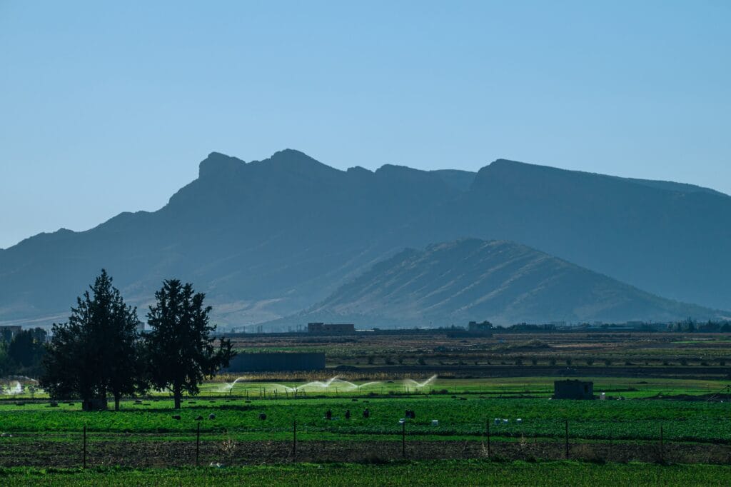
The High Atlas Mountain as a Living Heritage
The greatest mistake would be to treat the High Atlas Mountain as a museum.
It is not.
People still:
- farm its terraces,
- herd animals through its valleys,
- speak Amazigh languages,
- celebrate weddings,
- perform music,
- maintain irrigation systems,
- construct houses,
- migrate,
- return,
- adapt.
Its heritage is therefore living heritage.
FAQ: High Atlas Mountain
What is the High Atlas Mountain?
The High Atlas is Morocco’s highest mountain range and the highest part of the broader Atlas system. It extends across central Morocco from the Atlantic-influenced west toward the Moroccan–Algerian frontier and contains Jbel Toubkal, the highest summit in North Africa.
Where does the High Atlas Mountain begin and end?
The High Atlas Mountain broadly extends from the western Moroccan mountain region near the Atlantic toward the Moroccan–Algerian border. Its exact boundaries vary according to geological and geographical definitions.
What is the highest mountain in the High Atlas?
Jbel Toubkal, at 4,167 meters above sea level, is the highest summit of the High Atlas, Morocco, and North Africa.
Are the High Atlas Mountains Amazigh?
The High Atlas Mountain is home to predominantly Amazigh communities, although the region contains substantial linguistic and cultural diversity. Amazigh languages, traditions, agriculture, architecture, and customary institutions remain important components of High Atlas life.
What language do people speak in the High Atlas Mountain?
Several Amazigh varieties are spoken across the High Atlas, including Tashelhit and Central Atlas Tamazight depending on the region. Moroccan Arabic and French are also widely used.
Why is the High Atlas important to Morocco’s water supply?
The High Atlas Mountain receives precipitation and snow at high elevations and supplies runoff and groundwater that support mountain agriculture and surrounding plains. Research estimates that the range provides a very large share of irrigation water to surrounding agricultural regions.
What are the main traditions of the High Atlas Mountain?
Important traditions include mountain agriculture, pastoralism, weaving, communal resource management, oral poetry, music, dance, hospitality, seasonal celebrations, and customary institutions such as agdal.
Is the High Atlas good for hiking?
Yes. The range offers trekking opportunities ranging from relatively accessible valley walks to demanding high-altitude ascents such as Jbel Toubkal and M’Goun.
What is the best time to visit the High Atlas?
Spring and autumn are generally excellent for many valleys and trekking routes. Summer is suitable for high-altitude hiking but can be hot in lower valleys, while winter brings snow and more difficult conditions at high elevations.
What is the High Atlas famous for?
The High Atlas is famous for Jbel Toubkal, spectacular valleys, Amazigh villages, mountain agriculture, traditional architecture, prehistoric rock art, biodiversity, trekking, and its crucial role in Morocco’s water systems.
What is agdal in the High Atlas?
Agdal refers, in different High Atlas contexts, to customary systems regulating access to communal natural resources. Research identifies agdal as an important institution for resource governance among Amazigh communities.
Why is Oukaïmeden important?
Oukaïmeden is important for its prehistoric rock art, archaeological remains, high-altitude pastoral landscape, and continuing use by shepherds. Archaeological research there examines long-term relationships between people and mountain environments.
Is the High Atlas endangered by climate change?
Yes. Drought, changing precipitation, water scarcity, habitat degradation, and pressure on endemic species are major concerns. Recent research has identified substantial conservation risks for High Atlas endemic flora.
Comparison Table: The High Atlas Through Different Perspectives
| Perspective | What the High Atlas Represents | Key Evidence |
| Geography | A major Moroccan mountain system | Elevation, valleys, passes |
| Geology | An intracontinental orogenic belt | Faults, folds, rift inheritance |
| Hydrology | Major water-producing region | Snow, rainfall, runoff |
| Archaeology | Long-term human landscape | Rock art, settlements, pottery |
| Anthropology | Complex indigenous social systems | Agdal, kinship, pastoralism |
| Linguistics | Diverse Amazigh-speaking region | Toponyms and local varieties |
| Ecology | Biodiversity hotspot | Endemic flora and habitats |
| Agriculture | Mountain agroecosystem | Terraces, irrigation, agroforestry |
| Culture | Amazigh homeland | Language, music, traditions |
| Tourism | Major trekking destination | Toubkal, valleys, villages |
| Modern economy | Diversifying rural economy | Tourism, migration, cooperatives |
| Future challenge | Climate and socioeconomic change | Drought, migration, land-use change |
Conclusion: The High Atlas Is More Than a Mountain Range
The High Atlas is often introduced through its highest summit.
Jbel Toubkal rises to 4,167 meters, and its dramatic silhouette has become one of Morocco’s most recognizable mountain images.
But the true significance of the High Atlas begins when we look beyond the summit.
Below the peaks are valleys.
Within the valleys are terraces.
Within the terraces are agricultural systems.
Along the streams are villages.
Within the villages are families whose histories are connected to the land.
And within those communities survive languages, songs, memories, customary institutions, crafts, agricultural knowledge, and forms of hospitality that have developed through long interaction with an extraordinarily demanding environment.
The High Atlas is therefore not merely a geographical barrier.
It is a water system, ecological refuge, archaeological archive, cultural landscape, and living Amazigh homeland.
Its geological history reaches back hundreds of millions of years, while its human history stretches across prehistoric landscapes documented through rock art and archaeological remains. Research at Oukaïmeden and other High Atlas locations demonstrates that people have interacted with these environments over very long periods, while contemporary pastoral practices sometimes provide valuable insight into how mountain landscapes continue to function.
Its contemporary importance is equally profound.
The mountains supply water to surrounding agricultural regions. They contain highly threatened endemic species. They support rural communities whose livelihoods remain connected to agriculture and pastoralism. And they preserve cultural systems such as agdal that demonstrate sophisticated forms of communal resource management.
Yet the High Atlas is entering a period of profound transformation.
Climate change is increasing pressure on water resources. Rural–urban migration is changing village demographics. Traditional agriculture is being reorganized. Tourism is expanding. Infrastructure is improving connectivity while simultaneously transforming mountain landscapes. Biodiversity faces increasing threats from drought, overgrazing, habitat fragmentation, and other pressures.
The future of the High Atlas will therefore not be determined by preservation alone.
It will depend on adaptation.
The challenge is to allow mountain communities to benefit from modern education, healthcare, technology, tourism, and economic opportunity without treating their cultural heritage as an obstacle to development.
For travelers, this means looking beyond the summit.
Do not visit the High Atlas only to say that you climbed Toubkal.
Walk through the villages.
Observe the terraces.
Listen to the language.
Learn how water reaches a field.
Ask about the history of a mountain pass.
Eat the food of the valley.
Respect the people who live there.
Look at the rock engravings not merely as ancient images but as evidence of generations of human engagement with the landscape.
And remember that the most important heritage of the High Atlas is not frozen in the past.
It is alive.
The mountains continue to change.
The people continue to adapt.
The traditions continue to evolve.
And somewhere between the snow-covered summit, the ancient rock engraving, the irrigation channel, the village terrace, and the evening gathering over tea lies the deeper story of the High Atlas Mountain: a story not simply about height, but about the enduring relationship between people, place, memory, and survival.
References (APA Style)
- Boudou, A., et al. (2026). Rock art, rams, and rain: Modelling human–ovicaprine–mountain entanglements across Morocco’s High Atlas landscapes, Neolithic to present. Journal of Anthropological Archaeology, 82, 101773.
- Boubou, Y., Fastner, K., & Buerkert, A. (2025). Rural-urban transformation shapes oasis agriculture in Morocco’s High Atlas Mountains. Scientific Reports, 15, 3433.
- Boudad, L., et al. (2005). Crustal structure under the central High Atlas Mountains (Morocco) from geological and gravity data. Tectonophysics, 400(1–4), 67–84.
- Boudiaf, A., et al. (2007). Tectonic styles in the Marrakesh High Atlas (Morocco): The role of heritage and mechanical stratigraphy. Journal of African Earth Sciences, 48(4), 247–266.
- Brett, M., & Fentress, E. (1996). The Berbers. Blackwell.
- Camps, G. (1980). Berbères: Aux marges de l’histoire. Éditions des Hespérides.
- Domènech, M., Teixell, A., Babault, J., & Arboleya, M.-L. (2015). The inverted Triassic rift of the Marrakech High Atlas: A reappraisal of basin geometries and faulting histories. Tectonophysics.
- Ezziani, M. (2006). Nouvel essai de classification et de structuration des motifs des gravures rupestres du Haut Atlas (vallée de l’Ourika, Maroc). L’Anthropologie, 110(4), 580–597.
- FAO. (2011). Mountains Oases System in the Atlas Mountains of Morocco. Food and Agriculture Organization of the United Nations.
- Hoffman, K. E. (2008). We Share Walls: Language, Land, and Gender in Berber Morocco. Wiley-Blackwell.
- Ilahiane, H. (2006). Historical Dictionary of the Berbers (Imazighen). Scarecrow Press.
- International Council on Monuments and Sites. (2003). Principles for the conservation of earthen architectural heritage. ICOMOS.
- Maddy-Weitzman, B. (2011). The Berber Identity Movement and the Challenge to North African States. University of Texas Press.
- Missenard, Y., et al. (2008). High Atlas tectonic and geological evolution. In studies of the structural development of the Moroccan Atlas system.
- Pennell, C. R. (2000). Morocco Since 1830: A History. New York University Press.
- Piqué, A. (1994). Géologie du Maroc: Les domaines régionaux et leur évolution structurale. PUM.
- Rivet, D. (2012). Histoire du Maroc: De Moulay Idris à Mohammed VI. Fayard.
- Ruiz-Gálvez, M. L., et al. (2014). Art, landscape and settlement in the Oukaïmeden Valley, High Atlas. Research project documentation, Universidad Complutense de Madrid and Moroccan National Institute of Archaeological and Heritage Sciences.
- Sadiqi, F. (2003). Women, Gender and Language in Morocco. Brill.
- Teixell, A., Arboleya, M.-L., Charroud, M., & Julivert, M. (2003). Tectonic shortening and crustal structure of the High Atlas, Morocco. Tectonics.
- Tripodi, G. (2018). A note on some petroglyphs of the Moroccan High Atlas. Atti della Accademia Peloritana dei Pericolanti, Classe di Scienze Fisiche, Matematiche e Naturali.
- UNESCO. (2026). Morocco: Intangible Cultural Heritage. UNESCO Intangible Cultural Heritage.
- Van der Meijde, M., et al. (2005). Crustal structure and geodynamics of the High Atlas, Morocco. Tectonophysics.

2 Comments