Ait Ben Haddou: Exploring the Ancient Kasbahs, Oases, and Living Heritage
Aït Ben Haddou: The Living Citadel of Southern Morocco
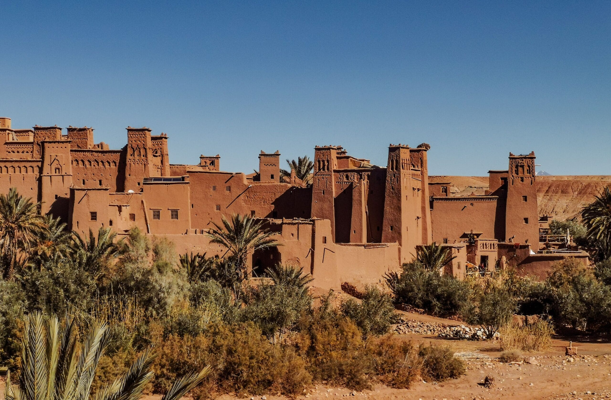
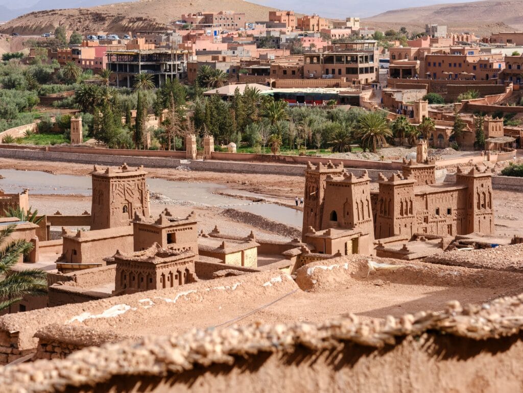
Among the many fortified settlements that define the cultural landscape of southern Morocco, none has achieved the international recognition of Aït Ben Haddou. Rising above the banks of the Ounila River, approximately 30 kilometers northwest of Ouarzazate, this remarkable earthen settlement is often described as Morocco’s most iconic ksar. Yet its fame should not overshadow its deeper significance. Aït Ben Haddou is not simply an architectural masterpiece or a popular filming location; it is one of the finest surviving examples of Amazigh communal planning, environmental adaptation, and trans-Saharan urbanism.
Unlike monumental cities founded by imperial dynasties, Aït Ben Haddou evolved gradually through the collective efforts of Amazigh families who transformed a strategic hillside into a fortified community capable of protecting both people and commerce. Every tower, courtyard, and passageway reflects centuries of accumulated knowledge rather than the vision of a single architect. Its extraordinary preservation allows historians, archaeologists, architects, and anthropologists to study how communities organized themselves in one of North Africa’s most demanding environments.
The enduring value of Aït Ben Haddou lies in its authenticity. While many medieval settlements have disappeared beneath modern construction, this ksar continues to preserve the spatial organization, construction techniques, and cultural logic that shaped Amazigh life across southern Morocco for generations.
Table of Contents
The Origins of Aït Ben Haddou
The precise origins of Aït Ben Haddou remain the subject of scholarly debate, largely because written documentation from its earliest centuries is scarce. Archaeological evidence suggests that the Ounila Valley had been inhabited long before the construction of the present settlement, benefiting from fertile agricultural land, dependable water resources, and its strategic position along routes crossing the High Atlas Mountains.
Most historians agree that the current ksar took shape between the eleventh and seventeenth centuries, although many of its architectural components were expanded, rebuilt, or modified over time. Rather than appearing all at once, Aït Ben Haddou developed organically as successive generations adapted the settlement to changing demographic, political, and economic circumstances.
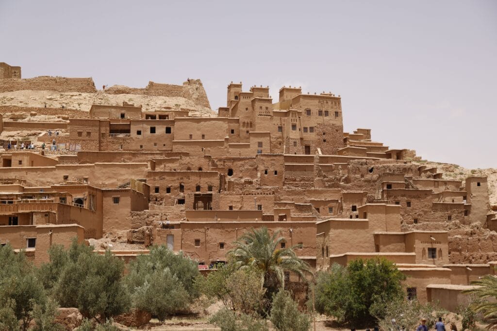
Its location was carefully chosen. Built upon a gentle hill overlooking the river, the ksar commanded extensive views of approaching travelers while remaining close to irrigated fields and orchards. This combination of defensive advantage and agricultural productivity explains why the settlement prospered for centuries despite the harsh climatic conditions of southern Morocco.
The name “Aït Ben Haddou” itself reflects Amazigh patterns of territorial identity. “Aït” generally denotes “the people of” or “the descendants of,” indicating a lineage or clan associated with a common ancestor. Although traditions identify a figure known as Ben Haddou, historians remain cautious about separating historical fact from oral memory. Regardless of the identity of this individual, the name emphasizes collective belonging rather than individual ownership—a defining characteristic of Amazigh social organization.
A Crossroads Between Marrakech and the Sahara
Aït Ben Haddou occupied one of the most strategic locations in pre-modern Morocco. Situated along the caravan corridor connecting Marrakech with the Drâa Valley and the Sahara, it became a vital stopping point for merchants transporting goods between North Africa and West Africa.
Caravans arriving from Timbuktu, Gao, and other Saharan centers carried commodities that were highly prized throughout the Mediterranean world. Gold, salt, leather, ivory, medicinal plants, ostrich feathers, and dates passed through southern Morocco before reaching the imperial cities of the north. In the opposite direction traveled textiles, ceramics, metal tools, horses, manuscripts, and luxury goods.
This commercial exchange generated remarkable prosperity for communities able to provide security, accommodation, food, water, and storage facilities. Aït Ben Haddou fulfilled all of these functions. Merchants found shelter within its fortified walls, while local farmers and craftsmen benefited from a constant flow of visitors representing diverse regions and cultures.
Trade also encouraged intellectual exchange. Islamic scholarship, architectural ideas, artistic techniques, legal traditions, and linguistic influences circulated alongside commercial goods. Consequently, Aït Ben Haddou became more than a marketplace; it served as a meeting point where the cultural worlds of the High Atlas, the Sahara, and the Mediterranean intersected.
Architecture Designed for Survival
At first glance, Aït Ben Haddou impresses visitors with its monumental towers crowned by geometric decorations. Closer examination reveals that every architectural element served practical as well as aesthetic purposes.
The ksar is enclosed by defensive walls punctuated with imposing corner towers that strengthened vulnerable points while providing elevated observation posts. Narrow entrances limited access, allowing residents to control movement during periods of insecurity. Once inside, winding streets reduced exposure to intense sunlight and slowed potential attackers.
Residential buildings were generally organized around internal courtyards, creating private domestic spaces protected from both climatic extremes and public view. Ground floors accommodated animals, storage rooms, and workshops, while upper levels served as living quarters. Rooftop terraces functioned as spaces for drying crops, social interaction, and household activities.
Construction relied almost entirely upon locally available materials. Rammed earth, adobe bricks, stone foundations, timber beams, and palm trunks created buildings whose thermal properties remain remarkably efficient even by contemporary standards. Thick earthen walls moderated indoor temperatures throughout the year, demonstrating an environmental intelligence increasingly admired by modern architects interested in sustainable design.
Decorative motifs carved into towers and façades were not merely ornamental. Geometric patterns expressed regional artistic traditions while simultaneously protecting vulnerable surfaces from erosion by channeling rainwater away from walls. Architecture therefore combined engineering, symbolism, and environmental adaptation into a unified whole.
Social Organization Inside the Ksar
The spatial organization of Aït Ben Haddou reflects the collective values of Amazigh society. Unlike many medieval towns characterized by rigid social segregation, the ksar functioned as an integrated community in which daily life depended upon cooperation among households.
Families shared communal infrastructure including wells, irrigation systems, ovens, mosques, storage facilities, and pathways. Agricultural production extended beyond the defensive walls into surrounding fields supplied by carefully maintained irrigation channels. Seasonal work such as harvesting, repairing buildings, and maintaining canals often required collective participation.
Community governance relied upon customary law and consultation rather than centralized bureaucracy. Elders, respected lineage representatives, and religious figures mediated disputes concerning land, water distribution, inheritance, and commercial transactions. These institutions strengthened social cohesion while enabling the community to respond collectively to external threats.
The architecture itself reinforced these relationships. Narrow streets encouraged regular interaction among neighbors, while shared courtyards and communal spaces fostered cooperation across generations. Privacy existed within family compounds, yet the broader layout emphasized mutual dependence rather than individual isolation.
Anthropologists have frequently described such settlements as examples of “architecture as social organization,” where built space actively shapes patterns of cooperation, authority, and identity.
Religion, Learning, and Spiritual Life
Although commerce played an essential role in Aït Ben Haddou’s prosperity, spiritual life formed an equally important foundation of the community.
The mosque occupied a central position within the ksar, serving not only as a place of worship but also as a center for education, legal consultation, and community discussion. Quranic instruction introduced children to literacy while reinforcing ethical principles that guided everyday interactions.
Nearby religious sanctuaries associated with local saints reflected another dimension of Amazigh Islam. Pilgrimage, seasonal gatherings, and commemorative festivals strengthened relationships among neighboring communities while preserving regional traditions integrated into broader Islamic practice.
Spiritual life was therefore inseparable from social organization. Religious institutions contributed to conflict resolution, education, charitable support, and the maintenance of communal solidarity.
UNESCO World Heritage Recognition
In 1987, Aït Ben Haddou was inscribed on the UNESCO World Heritage List, recognizing its outstanding universal value as one of the world’s best-preserved examples of southern Moroccan earthen architecture.
UNESCO emphasized several characteristics that distinguish the ksar:
- Exceptional preservation of traditional rammed-earth construction techniques.
- Outstanding representation of pre-Saharan fortified settlements.
- Continuous interaction between architecture and landscape.
- Historical importance within trans-Saharan trade networks.
- Cultural significance for Amazigh communities.
The designation also acknowledged the vulnerability of earthen architecture. Unlike stone monuments, adobe and rammed-earth structures require continuous maintenance. Rainfall, erosion, changing river courses, and abandonment can rapidly accelerate deterioration if conservation efforts cease.
Since inscription, restoration projects have sought to preserve traditional construction methods while encouraging sustainable tourism. Rather than replacing earthen buildings with modern materials, conservation specialists increasingly recognize that authenticity depends upon maintaining the knowledge and craftsmanship that originally created these structures.
Archaeological Research at Aït Ben Haddou
Archaeological investigations have demonstrated that the visible ksar represents only one phase within a much longer history of settlement in the Ounila Valley.
Studies of construction techniques reveal multiple periods of rebuilding, expansion, and repair corresponding to demographic growth, changing political conditions, and environmental challenges. Stratigraphic evidence indicates that successive generations continually modified buildings rather than abandoning and replacing them entirely.
Ceramic fragments, architectural remains, irrigation infrastructure, and agricultural terraces provide valuable insights into everyday life beyond monumental architecture. Together they illustrate a diversified economy based upon farming, animal husbandry, craftsmanship, and regional commerce.
Researchers increasingly emphasize that archaeological interpretation must integrate material evidence with oral traditions preserved by local communities. Many aspects of social organization, seasonal rituals, construction practices, and place names survive primarily through collective memory rather than written documentation.
This combination of archaeological research and living heritage makes Aït Ben Haddou particularly valuable as a cultural landscape where tangible and intangible heritage remain closely interconnected.
A Living Heritage Rather Than an Open-Air Museum
Perhaps the most remarkable characteristic of Aït Ben Haddou is that it has never been merely a historical monument.
Although many families gradually relocated across the river during the twentieth century in search of modern amenities, several households continue to maintain ancestral homes within the ksar. Traditional agricultural practices remain visible in surrounding fields, while local artisans continue producing crafts that reflect regional knowledge transmitted across generations.
This continuity distinguishes Aït Ben Haddou from archaeological sites preserved solely as ruins. Visitors encounter not only architecture but also living traditions shaped by Amazigh hospitality, oral history, craftsmanship, cuisine, and seasonal rhythms that continue to animate the landscape.
For this reason, the ksar should be understood not as a frozen relic of the past but as a dynamic cultural environment where heritage remains part of everyday life. Its significance lies not only in the survival of earthen walls but also in the resilience of the communities whose knowledge has preserved them across centuries.
While Aït Ben Haddou represents the most celebrated fortified settlement in the region, it forms only one chapter in the broader architectural history of Ouarzazate. The surrounding valleys contain dozens of remarkable kasbahs, each reflecting different political histories, tribal traditions, and environmental adaptations.
Kasbah Taourirt: The Political and Cultural Heart of Ouarzazate
If Aït Ben Haddou represents the communal soul of southern Morocco’s fortified settlements, Kasbah Taourirt embodies their political evolution. Rising above the modern city of Ouarzazate, this immense earthen complex stands among the most sophisticated examples of Amazigh residential architecture in North Africa. It is frequently described as a kasbah, yet in reality it is an architectural ensemble composed of interconnected residences, ceremonial halls, defensive towers, courtyards, granaries, reception rooms, and service quarters that expanded continuously over several centuries.
Unlike Aït Ben Haddou, whose identity was closely tied to caravan communities, Kasbah Taourirt became associated with regional governance, diplomacy, and the administration of southern Morocco. It illustrates how traditional Amazigh architecture adapted as political authority became increasingly centralized while still preserving indigenous construction techniques and social organization.
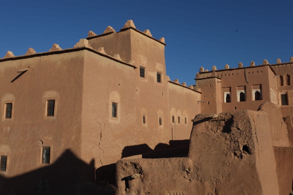
Today, visitors often admire its intricate façades and labyrinthine interior without realizing that every passage, staircase, and tower reflects changing patterns of power, trade, and family life extending across generations.
The Origins of Kasbah Taourirt
Although earlier structures likely occupied the site, the present kasbah largely developed between the seventeenth and nineteenth centuries, expanding significantly during the late nineteenth and early twentieth centuries under influential regional leaders.
The word Taourirt derives from Amazigh and is generally interpreted as “small hill” or “elevated place.” The name accurately reflects the kasbah’s strategic position overlooking the surrounding plain. Elevated terrain provided natural defensive advantages while allowing surveillance of caravan routes approaching from the Atlas Mountains and the Drâa Valley.
Rather than following a predetermined architectural plan, Kasbah Taourirt expanded organically. As families grew and political influence increased, new residential wings, towers, courtyards, reception halls, and storage facilities were added. The resulting complexity resembles a living organism rather than a symmetrical palace.
This gradual process demonstrates one of the defining characteristics of Amazigh architecture: buildings evolved according to social needs rather than rigid geometric principles.
Architecture Designed for Governance
Kasbah Taourirt differs fundamentally from ordinary residential compounds because it functioned simultaneously as:
- a family residence,
- an administrative headquarters,
- a diplomatic reception center,
- a commercial hub,
- and a defensive fortress.
This combination required remarkable architectural flexibility.
Visitors entered through heavily protected gateways designed to regulate access. Public reception rooms occupied lower levels where merchants, tribal representatives, and travelers could conduct business without entering private family quarters. Administrative spaces accommodated negotiations, dispute resolution, and political meetings.
Upper floors provided increasingly private residential areas reserved for extended family members. Rooftops served as observation platforms from which guards monitored surrounding roads and cultivated lands.
Storage rooms held grain, olive oil, dried fruit, textiles, weapons, and valuable commercial goods. In times of conflict these reserves ensured that inhabitants could withstand prolonged sieges without relying upon external supplies.
Such multifunctional design reflects a sophisticated understanding of governance in frontier regions where economic prosperity, political authority, and collective security remained inseparable.
Decorative Art Beyond Ornament
Kasbah Taourirt is celebrated not only for its monumental scale but also for its extraordinary decorative craftsmanship.
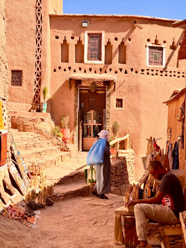
Its towers display finely executed geometric motifs carved into earthen plaster. Diamond patterns, zigzags, triangular compositions, and stepped designs animate otherwise massive walls with rhythmic visual movement.
These decorative elements possess multiple layers of meaning.
From an engineering perspective, projecting relief helped channel rainwater away from vulnerable surfaces while reducing erosion.
Artistically, the motifs expressed regional Amazigh aesthetics characterized by abstraction rather than figurative representation.
Anthropologists further interpret many of these geometric designs as visual expressions of protection, fertility, continuity, and social harmony, echoing symbolic vocabulary also found in Amazigh textiles, jewelry, wood carving, and body art.
Thus, decoration functioned simultaneously as engineering, artistic identity, and cultural communication.
Climate Intelligence: Architecture Adapted to the Desert
Modern sustainable architecture increasingly recognizes principles that Amazigh builders mastered centuries ago.
Kasbah Taourirt demonstrates remarkable environmental adaptation through passive climate control.
Its thick earthen walls create substantial thermal mass, absorbing daytime heat and releasing it gradually after sunset. Narrow streets reduce direct solar exposure while encouraging air circulation through shaded corridors.
Small exterior openings minimize heat gain during summer months, whereas internal courtyards provide cooler microclimates where families gathered throughout the day.
Timber ceilings constructed from cedar, palm trunks, tamarisk, and other regional woods distributed structural loads efficiently while allowing ventilation beneath roof terraces.
The orientation of buildings carefully balanced sunlight, prevailing winds, and seasonal temperature variation.
Rather than imposing architecture upon the environment, builders collaborated with natural climatic processes to create comfortable living conditions without mechanical technology.
Today, these techniques inspire architects exploring environmentally responsible alternatives to energy-intensive construction.
The Glaoua and Regional Power
Kasbah Taourirt became particularly prominent during the rise of the Glaoua family, whose influence extended across much of southern Morocco during the nineteenth and early twentieth centuries.
The Glaoua established extensive political alliances controlling strategic mountain passes, caravan routes, and agricultural territories linking Marrakech with the Sahara.
Although their authority eventually became intertwined with broader Moroccan state structures and later the French Protectorate, their power rested fundamentally upon their ability to negotiate relationships with Amazigh tribal confederations throughout the High Atlas and pre-Saharan regions.
Kasbah Taourirt functioned as an administrative center where taxation, commercial agreements, diplomatic negotiations, and regional governance converged.
Historical accounts describe continuous movement through its gates: merchants arriving with camel caravans, tribal delegates resolving disputes, scholars carrying manuscripts, craftsmen delivering goods, and travelers seeking protection before continuing toward the desert.
The kasbah therefore operated as a dynamic political landscape rather than merely an impressive residence.
Daily Life Inside the Kasbah
Behind its imposing walls unfolded a remarkably complex social world.
Extended families occupied interconnected residential quarters organized according to kinship relationships and household responsibilities.
Women supervised domestic economies including food preparation, textile production, child education, storage management, and hospitality. Their work sustained the internal functioning of the kasbah while preserving oral traditions, weaving techniques, medicinal knowledge, and linguistic continuity.
Men participated in agriculture, trade, diplomacy, construction, and seasonal caravan activities. Yet responsibilities frequently overlapped, particularly during harvest seasons, festivals, and collective maintenance projects.
Children learned practical skills from an early age through observation and participation rather than formal instruction alone. Building techniques, agricultural practices, storytelling, music, and craftsmanship were transmitted through daily interaction across generations.
Religious celebrations, weddings, harvest festivals, and communal meals strengthened relationships among households while reinforcing shared cultural values.
Anthropologically, the kasbah may therefore be understood as a microcosm of Amazigh society in which architecture structured social interaction while simultaneously adapting to changing demographic needs.
Kasbah Taourirt and the Preservation of Amazigh Identity
Although Kasbah Taourirt later became associated with influential political elites, its deeper architectural language remained unmistakably Amazigh.
Construction techniques, decorative vocabulary, spatial organization, and environmental adaptation all emerged from indigenous traditions refined across centuries within southern Morocco.
This continuity demonstrates that Amazigh identity cannot be reduced solely to language or ethnicity. It is equally expressed through building practices, agricultural knowledge, water management, artisanal craftsmanship, social organization, and relationships with the surrounding landscape.
Every restored tower therefore preserves more than architectural heritage; it safeguards an entire knowledge system developed through generations of practical experience.
For this reason, conservation specialists increasingly emphasize that preserving Kasbah Taourirt requires supporting traditional earthen construction skills alongside physical restoration.
Without the artisans capable of repairing rammed-earth walls using inherited techniques, the monument itself cannot survive authentically.
From Fortress to Cultural Monument
The twentieth century introduced profound transformations.
Modern roads gradually replaced caravan routes.
Administrative institutions shifted toward newly expanding urban centers.
Many families relocated to contemporary housing equipped with electricity, plumbing, and modern infrastructure.
Like numerous earthen monuments throughout Morocco, Kasbah Taourirt experienced periods of neglect during which sections deteriorated under the combined effects of rainfall, erosion, and abandonment.
Restoration initiatives launched in recent decades have sought to stabilize vulnerable structures while respecting traditional construction methods.
These projects illustrate an important evolution within heritage conservation. Increasingly, preservation is understood not simply as protecting historic buildings but as sustaining living craftsmanship, community participation, and cultural memory.
Visitors today therefore encounter a monument undergoing continuous dialogue between past and present rather than a static archaeological ruin.
Kasbah Taourirt in Contemporary Scholarship
For archaeologists, Kasbah Taourirt offers an exceptional laboratory for studying earthen architecture, settlement evolution, and material culture.
Architects examine its passive environmental design as a model for sustainable construction.
Anthropologists investigate how spatial organization reflects kinship systems, gender relations, and community governance.
Historians analyze archival sources documenting political transformations during the late precolonial and colonial periods.
Linguists explore the persistence of Amazigh place names and oral traditions associated with the surrounding landscape.
Together these disciplines reveal that Kasbah Taourirt cannot be understood through architecture alone. It represents an integrated cultural system in which environment, politics, language, economy, religion, and collective memory remain inseparable.
Beyond Ouarzazate’s Walls
Although Kasbah Taourirt became the administrative heart of the region, the surrounding valleys contain equally remarkable cultural landscapes that illustrate different dimensions of Amazigh civilization.
The Skoura Oasis, with its vast palm groves and historic kasbahs, demonstrates how agriculture, irrigation, and architecture formed a unified ecological system. Kasbah Amridil preserves one of Morocco’s finest examples of traditional oasis architecture, while the secluded Fint Oasis reveals how communities adapted to life in one of the country’s most dramatic desert environments.
These landscapes show that Ouarzazate’s heritage extends far beyond individual monuments. Together they form one of the largest surviving cultural landscapes of earthen Amazigh civilization anywhere in North Africa, where architecture, water, agriculture, and community continue to shape one another across centuries.
Skoura Oasis: The Green Heart of Ouarzazate’s Amazigh Civilization
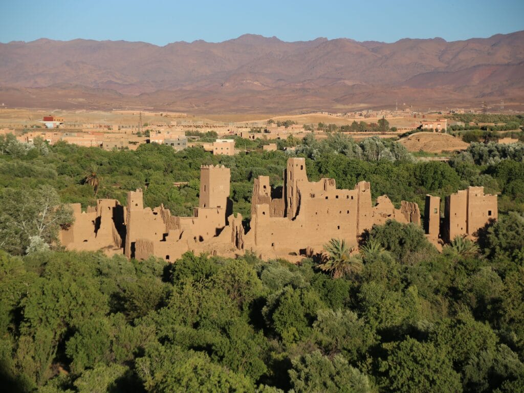
Traveling east from Ouarzazate, the landscape appears at first to surrender completely to stone, gravel, and the ochre tones of the pre-Saharan plateau. Then, almost unexpectedly, an immense ribbon of green emerges from the horizon. Thousands of palm trees rise above fertile fields, ancient irrigation canals, mud-brick villages, and fortified kasbahs. This is Skoura Oasis, one of Morocco’s largest and most historically significant oasis systems, where the ingenuity of Amazigh communities transformed an arid environment into a flourishing cultural landscape.
Unlike isolated palm groves that developed around individual springs, Skoura evolved as a vast agricultural network sustained by carefully managed water resources and centuries of communal cooperation. More than a picturesque destination, the oasis represents a remarkable example of how ecological knowledge, social organization, and architectural innovation combined to create one of southern Morocco’s most resilient settlements.
For historians, Skoura illustrates the agricultural foundation that supported caravan commerce. For anthropologists, it reveals how oasis communities organized collective life around shared resources. For architects, its kasbahs demonstrate the highest achievements of earthen construction. For visitors, it offers perhaps the clearest understanding of why Ouarzazate cannot be separated from the surrounding valleys that have sustained its civilization for generations.
Geography and Environmental Setting
Skoura lies approximately 40 kilometers east of Ouarzazate, occupying a fertile section of the upper Drâa basin where seasonal rivers descending from the High Atlas replenish underground aquifers. The oasis extends across dozens of square kilometers, creating one of the most extensive palm groves in southern Morocco.
Its environment demonstrates an extraordinary ecological contrast. Beyond the cultivated zone stretch rocky plateaus and semi-arid hills receiving limited annual rainfall. Within the oasis, however, water supports dense vegetation including date palms, olive trees, almond orchards, fig trees, pomegranates, apricots, vegetables, cereals, and aromatic herbs.
This transformation was never accidental. It reflects centuries of careful environmental management through irrigation systems that distributed water efficiently while preventing waste in one of Morocco’s driest regions.
Modern environmental historians increasingly describe Skoura as a cultural ecosystem in which agriculture, architecture, and water management function as inseparable components of a single landscape.
Water as Collective Heritage
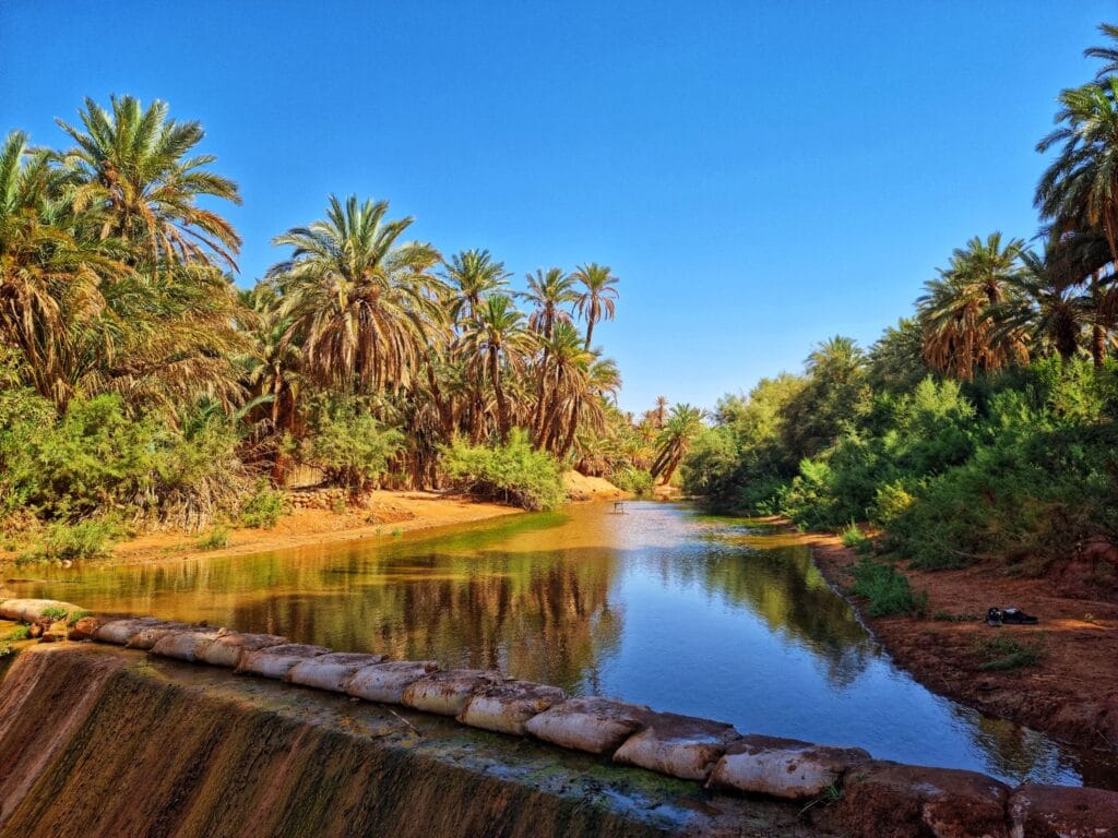
The true foundation of Skoura is neither its palm trees nor its kasbahs but its sophisticated relationship with water.
For Amazigh communities, water has always represented a communal resource governed by customary law rather than unrestricted private ownership. Seasonal flows descending from the High Atlas were carefully captured and distributed through networks of canals that required constant maintenance and collective responsibility.
Each household received access according to agreements developed through generations of negotiation. Water allocation often followed precise schedules ensuring equitable distribution during periods of scarcity.
Village assemblies supervised repairs, resolved disputes, and coordinated communal labor necessary to maintain irrigation infrastructure.
Anthropologists frequently note that these systems created strong social cohesion because every family depended upon the cooperation of its neighbors. Water therefore became not only an environmental necessity but also a social institution reinforcing solidarity, reciprocity, and mutual trust.
Without this collective governance, neither agriculture nor permanent settlement could have survived in the oasis.
The Three-Layer Agricultural System
One of the most remarkable characteristics of Skoura is its vertically organized agricultural landscape.
Rather than cultivating a single crop, Amazigh farmers developed a multilayered system that maximized productivity while protecting soil and conserving moisture.
Upper Layer: Date Palms
Towering date palms formed the upper canopy, reducing direct sunlight and creating favorable conditions for crops growing beneath them. Their fruit provided nutrition, trade goods, and valuable income while their trunks and leaves supplied construction materials, fuel, baskets, mats, and roofing elements.
Middle Layer: Fruit Trees
Beneath the palms flourished olive trees, almonds, figs, apricots, pomegranates, and other fruit-bearing species. These diversified production, reduced economic risk, and enriched local diets.
Lower Layer: Cereals and Vegetables
Ground-level cultivation included barley, wheat, beans, onions, herbs, and seasonal vegetables nourished by filtered sunlight and carefully regulated irrigation.
Contemporary agricultural scientists recognize this arrangement as an exceptionally sustainable model that conserves water, reduces evaporation, improves biodiversity, and increases long-term resilience against climatic variability.
Long before modern concepts of agroecology emerged, Amazigh farmers had already developed sophisticated ecological strategies perfectly adapted to oasis environments.
Kasbah Amridil: A Masterpiece of Earthen Architecture
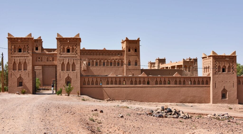
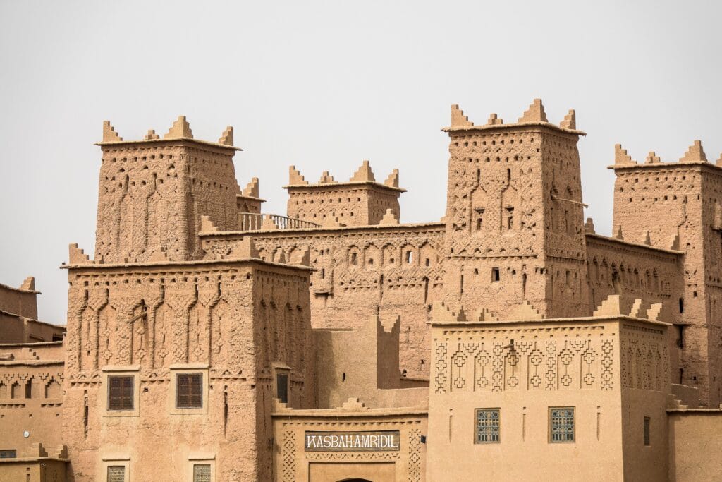
Among the dozens of fortified residences scattered across Skoura, Kasbah Amridil stands as perhaps the finest surviving example of traditional oasis architecture in Morocco.
Constructed primarily during the seventeenth century and expanded over subsequent generations, the kasbah reflects the remarkable maturity of Amazigh earthen construction techniques.
Its elegant towers display finely executed geometric ornamentation, while its massive walls continue to regulate interior temperatures despite the harsh desert climate.
Inside, visitors encounter an architectural world organized around practical functionality.
Ground floors accommodated livestock, agricultural equipment, olive presses, grain mills, and storage facilities.
Upper levels contained reception rooms, family quarters, weaving spaces, and elevated terraces overlooking the surrounding oasis.
Every element reveals careful adaptation to environmental conditions. Thick earthen walls insulated interiors from extreme heat. Limited exterior openings minimized solar exposure. Internal courtyards improved ventilation while creating sheltered spaces for domestic life.
Unlike many restored monuments reconstructed with modern materials, Kasbah Amridil preserves a remarkable degree of architectural authenticity, making it an invaluable resource for researchers studying traditional building technology.
Architecture as Environmental Knowledge
Kasbah Amridil demonstrates that architecture in southern Morocco functioned as a form of environmental science.
Builders selected local soils according to their mineral composition, adjusting mixtures of clay, sand, gravel, and straw to achieve optimal structural performance.
Timber beams distributed loads while allowing flexibility during seasonal temperature changes.
Decorative façades reduced erosion by controlling rainwater runoff.
Roof terraces supported agricultural activities including drying dates, grain, herbs, and wool.
Construction therefore reflected accumulated empirical knowledge refined through centuries of observation rather than abstract theoretical design.
Modern sustainable architecture increasingly recognizes these techniques as valuable models for reducing energy consumption and utilizing renewable local materials.
Daily Life in the Oasis
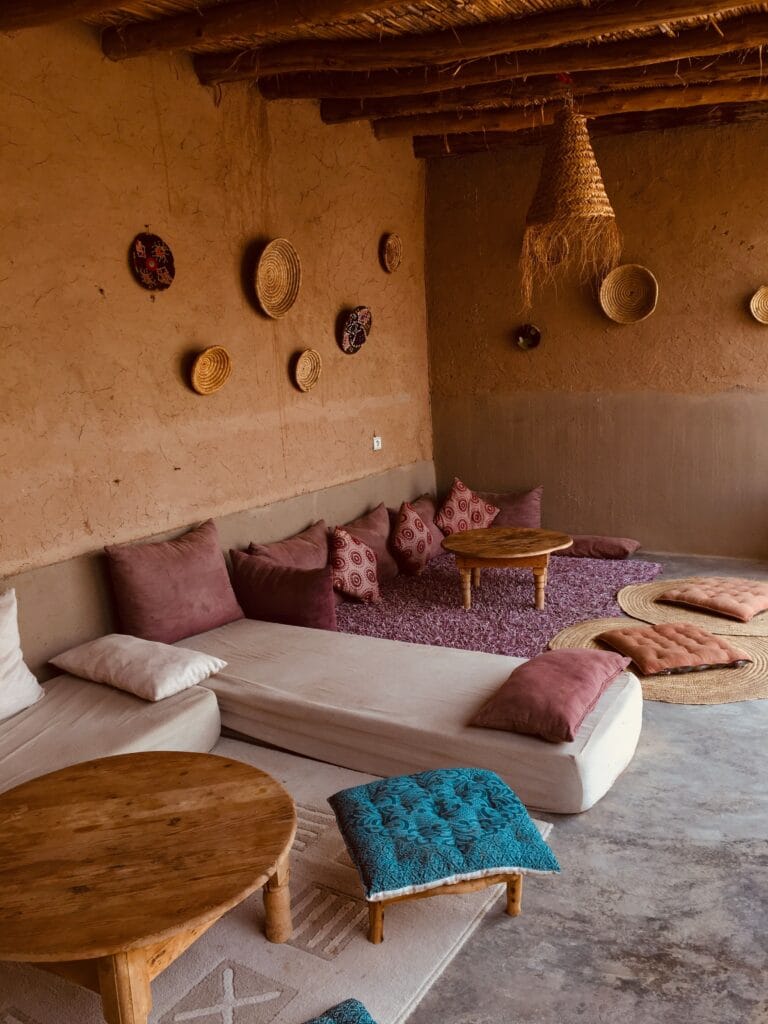
Life within Skoura followed seasonal rhythms determined by agriculture rather than political calendars.
Spring brought irrigation maintenance, planting, and flowering orchards.
Summer demanded careful water management while families harvested early fruits and prepared storage facilities.
Autumn marked the date harvest, one of the year’s most important communal activities.
Winter allowed maintenance of buildings, weaving, tool production, storytelling, and social gatherings.
These annual cycles shaped every aspect of community life.
Women played central roles in food preservation, weaving, household management, medicinal plant knowledge, and oral education.
Men combined farming with seasonal trade, animal husbandry, construction, and caravan activities.
Children gradually acquired practical knowledge through participation in agricultural work and domestic responsibilities.
Festivals accompanying harvests and religious celebrations strengthened community cohesion while reinforcing collective identity across generations.
Biodiversity and Traditional Ecological Knowledge
Skoura represents far more than cultivated farmland.
Its complex ecosystem supports birds, pollinating insects, reptiles, medicinal plants, and numerous native species adapted to oasis environments.
Traditional Amazigh ecological knowledge recognized intimate relationships between agriculture and biodiversity.
Farmers intentionally preserved shade trees, protected beneficial wildlife, rotated crops, and utilized organic fertilizers long before these practices became central to modern sustainability discussions.
Medicinal plants gathered from surrounding hills contributed to traditional healthcare systems combining botanical knowledge with inherited healing practices.
Such ecological understanding illustrates how cultural heritage extends beyond architecture into environmental stewardship developed through centuries of observation.
Oral Traditions of the Oasis
The history of Skoura has never been preserved solely in written chronicles.
Even today, many families continue transmitting genealogies, historical narratives, agricultural knowledge, proverbs, and poetry through oral tradition.
Professional storytellers, village elders, and musicians have long served as custodians of collective memory.
Their narratives recount the founding of villages, legendary ancestors, caravan journeys, droughts, conflicts, miraculous events, and seasonal rituals that shaped communal identity.
Linguists consider these oral traditions invaluable because they preserve local vocabulary, place names, and expressions often absent from official historical documents.
Combined with archaeological evidence, oral history provides a richer and more nuanced understanding of oasis civilization than written sources alone.
Skoura in the Twenty-First Century
Today, Skoura stands at the intersection of preservation and transformation.
Tourism has generated new economic opportunities while increasing international appreciation for Amazigh architecture and cultural landscapes.
Family guesthouses established within restored kasbahs allow visitors to experience traditional architecture while supporting local communities.
Agricultural cooperatives promote dates, olive oil, almonds, honey, and handcrafted products through regional and international markets.
At the same time, environmental pressures present significant challenges.
Climate change, declining groundwater levels, rural migration, and changing agricultural practices threaten the ecological balance that sustained the oasis for centuries.
Conservation therefore increasingly requires integrated approaches combining heritage preservation, sustainable tourism, ecological restoration, and community participation.
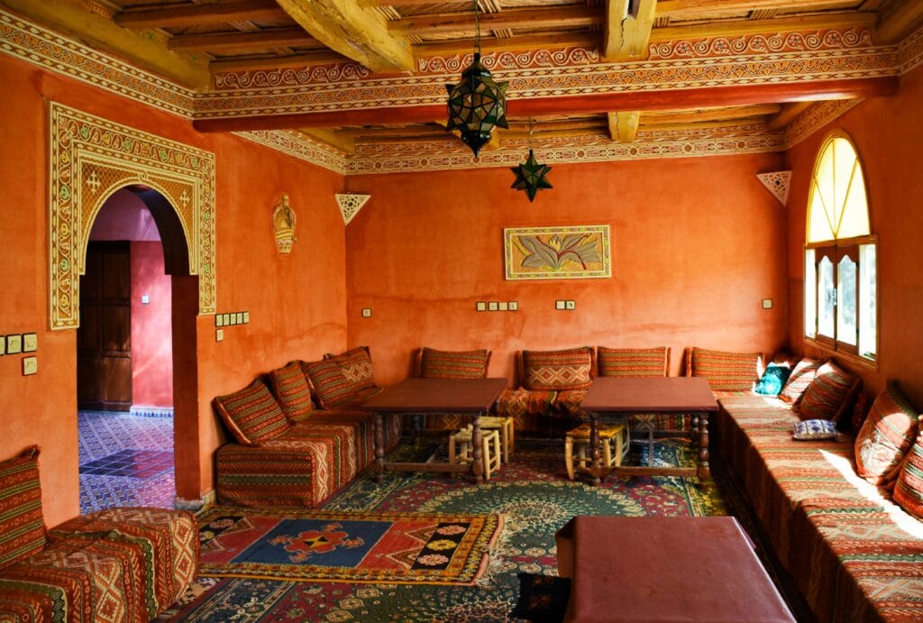
The future of Skoura depends not simply upon restoring monuments but upon maintaining the living relationship between water, agriculture, architecture, and Amazigh cultural knowledge.
Why Skoura Matters Beyond Morocco
For international scholars, Skoura represents one of the world’s outstanding examples of a living oasis civilization.
Its significance extends beyond Moroccan history because it demonstrates universal principles of sustainable settlement:
- adapting architecture to climate,
- managing scarce water collectively,
- integrating agriculture with biodiversity,
- preserving cultural identity through everyday practices,
- and balancing economic development with environmental resilience.
In an era increasingly defined by climate uncertainty and resource scarcity, the lessons embodied within Skoura possess renewed global relevance.
Its palm groves, kasbahs, irrigation systems, and oral traditions remind us that sustainability is not a modern invention but a centuries-old practice refined by communities whose survival depended upon respecting the ecological limits of their environment.
Beyond the fertile palm groves of Skoura lies another remarkable landscape that reveals a different face of southern Morocco. Hidden among dramatic rocky hills west of Ouarzazate, the Fint Oasis preserves one of the region’s most secluded Amazigh settlements, where ancient caravan paths, traditional hospitality, oral traditions, and desert ecology continue to shape everyday life much as they have for centuries.
Fint Oasis: The Hidden Amazigh Paradise Beyond Ouarzazate
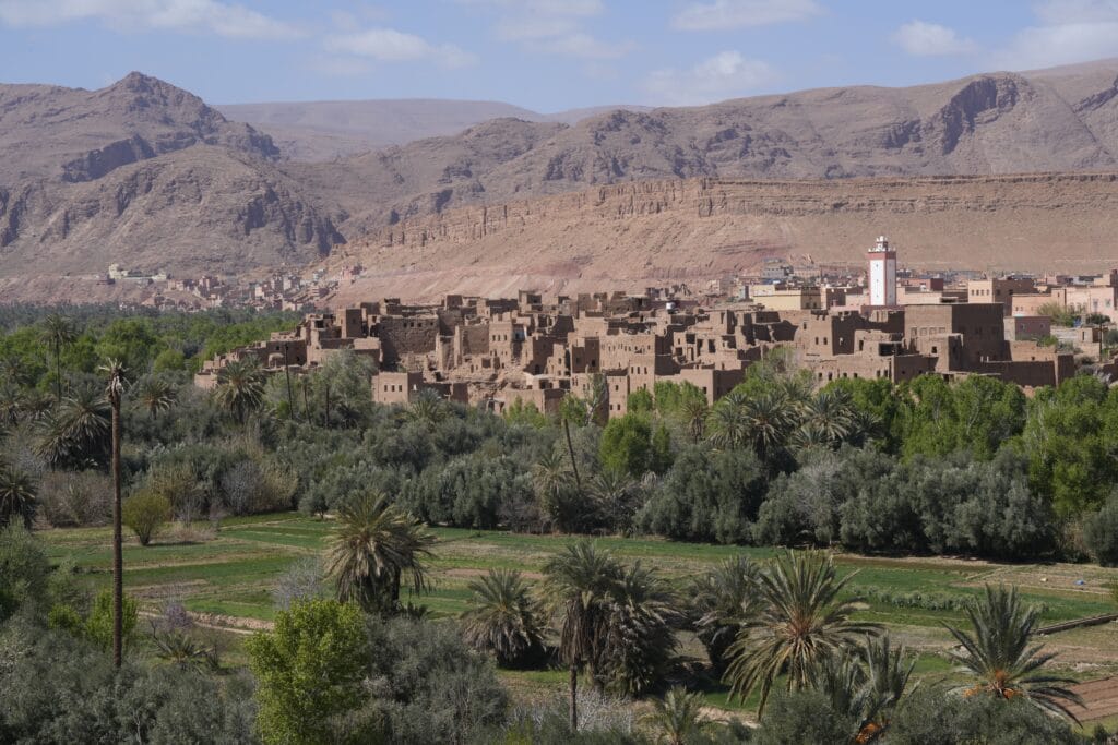
Only about 15 kilometers southwest of Ouarzazate, beyond a landscape of rocky hills, dry riverbeds, and volcanic plateaus, lies one of southern Morocco’s best-preserved cultural landscapes. Known as Fint Oasis (Tamazight: Afint), this secluded valley appears almost miraculously after miles of seemingly barren terrain. Dense groves of date palms, small cultivated fields, earthen villages, and flowing water create a striking contrast with the surrounding desert, offering a vivid example of how Amazigh communities have long adapted to some of North Africa’s most challenging environments.
Unlike the larger and more commercially known oasis of Skoura, Fint has retained a quieter and more intimate character. It is not simply a destination for photography or relaxation but a living cultural landscape where architecture, agriculture, oral tradition, and community life continue to reflect centuries of Amazigh knowledge. For anthropologists, Fint represents a valuable example of how relatively isolated communities preserved traditional social structures. For archaeologists and historians, it offers insight into the caravan networks that once connected the Sahara with the High Atlas. For travelers, it provides an authentic encounter with rural Morocco beyond the country’s famous monuments.
The Meaning of “Fint”
The name Fint is widely believed to derive from the Tamazight language, although scholars propose several interpretations linked to local geography and water sources. Like many Amazigh place names, it reflects the intimate relationship between language and landscape. Throughout southern Morocco, geographical names frequently describe springs, valleys, mountains, vegetation, or environmental features rather than commemorating political figures.
This linguistic tradition illustrates an important characteristic of Amazigh culture: identity has historically been rooted in place. Villages, rivers, mountain passes, and cultivated lands became repositories of collective memory, preserving ancient vocabulary long after political boundaries changed.
Even today, many local residents continue to use Amazigh place names alongside Arabic forms, demonstrating the remarkable continuity of indigenous linguistic heritage.
Geography: An Oasis Hidden by Stone
The approach to Fint explains why the oasis remained relatively protected for centuries. Travelers cross an apparently inhospitable landscape dominated by dark rock formations, gravel plains, and deeply eroded wadis before suddenly descending into a lush valley nourished by seasonal watercourses and underground springs.
This dramatic transition has often surprised merchants, explorers, and modern visitors alike. Historical caravan travelers regarded such oases not merely as convenient stopping points but as essential lifelines where water, food, shelter, and security could be found after difficult journeys through semi-desert environments.
The surrounding cliffs also created a natural defensive barrier, reducing the likelihood of large-scale attacks while encouraging the development of closely connected village communities.
Today, the visual contrast between barren hills and green vegetation remains one of Fint’s defining characteristics, illustrating the extraordinary impact of traditional water management in arid regions.
Traditional Amazigh Villages
Several Amazigh villages are distributed throughout the oasis, each characterized by traditional earthen architecture that harmonizes with the surrounding landscape.
Houses were constructed primarily from rammed earth, adobe bricks, stone foundations, and palm trunks. Their earthy colors blend almost seamlessly with nearby hills, reflecting both practical environmental adaptation and a longstanding Amazigh aesthetic emphasizing harmony with nature rather than visual dominance.
Residential compounds generally include:
- Interior courtyards that provide shade and privacy.
- Flat roofs used for drying crops, storing agricultural products, and social activities.
- Thick earthen walls that regulate indoor temperatures throughout the year.
- Small windows designed to minimize heat while allowing natural ventilation.
- Storage rooms for dates, grain, olive oil, and household supplies.
Unlike monumental kasbahs built for political elites, the architecture of Fint reflects everyday rural life, emphasizing functionality, family cooperation, and environmental efficiency.
Anthropologists frequently note that such villages reveal how domestic architecture reinforces social relationships, encouraging close interaction among extended families while preserving private household spaces.
Water Management and Collective Cooperation
Like every successful oasis in southern Morocco, Fint owes its existence to water. Yet the significance of water extends far beyond agriculture.
Traditional irrigation systems distribute water through carefully maintained channels that guide seasonal flows toward cultivated fields. These systems required constant communal labor and detailed agreements regulating access among families.
Rather than allowing unrestricted use, Amazigh customary law established precise schedules determining when each household could irrigate its fields. Such arrangements minimized conflict while ensuring that limited water resources benefited the entire community.
Village assemblies periodically organized maintenance of canals, repaired flood damage, and negotiated adjustments during drought years. These collective institutions demonstrate that environmental sustainability depended as much upon social organization as engineering.
Contemporary researchers increasingly recognize these customary water-management systems as valuable examples of community-based environmental governance that remain relevant in today’s discussions of climate adaptation.

Agriculture: A Desert Made Fertile
Although rainfall is limited, the oasis supports a surprisingly diverse agricultural economy.
Date palms dominate the landscape, creating shade that protects lower vegetation from intense desert sunlight. Beneath this canopy flourish olive trees, almond trees, figs, pomegranates, and seasonal vegetables carefully adapted to local conditions.
Small cereal plots, aromatic herbs, and fodder crops support both human consumption and livestock production.
Traditional agriculture emphasizes diversity rather than specialization. This strategy reduces vulnerability to drought, pests, and fluctuating market prices while maintaining ecological resilience.
Families historically relied upon a combination of farming, animal husbandry, seasonal trade, weaving, and craftsmanship, ensuring that economic survival did not depend upon a single activity.
Such diversified livelihoods remain one of the defining characteristics of Amazigh rural economies throughout southern Morocco.
Amazigh Hospitality in the Oasis
Visitors to Fint frequently remark that its greatest attraction is not the landscape but the warmth of its people.
Hospitality occupies a central place in Amazigh social values. Welcoming guests has long represented both a moral obligation and a source of communal honor. Travelers arriving after difficult journeys traditionally received food, tea, shelter, and protection before any discussion of business or personal matters.
Tea ceremonies remain particularly significant.
Preparing mint tea involves carefully measured steps that symbolize generosity, patience, and respect rather than mere refreshment. Bread baked in traditional ovens, locally produced olive oil, dates, almonds, and seasonal fruits often accompany these gatherings.
Anthropologists emphasize that such practices strengthen social bonds while transforming hospitality into an essential institution of community life.
Even as tourism expands, many families continue to preserve these traditions, offering visitors opportunities to experience cultural exchange rather than purely commercial transactions.
Oral Tradition and Cultural Memory
The relative isolation of Fint has helped preserve a rich oral heritage transmitted across generations.
Evenings traditionally provided opportunities for elders to recount stories concerning ancestral migrations, caravan journeys, local saints, remarkable droughts, tribal alliances, and legendary figures associated with the surrounding landscape.
Music also plays an important role.
Traditional Amazigh songs performed during weddings, harvest celebrations, and communal gatherings preserve historical narratives alongside expressions of collective identity. Instruments such as the ribab, frame drums, and rhythmic hand-clapping accompany performances whose origins often extend back centuries.
For linguists, these oral traditions represent invaluable archives preserving vocabulary, pronunciation, and expressions that rarely appear in written texts.
Together with architecture and agriculture, storytelling forms another essential component of Fint’s cultural heritage.
Wildlife and Environmental Diversity
Although primarily recognized for its human heritage, Fint also supports remarkable biodiversity.
The combination of water, vegetation, rocky cliffs, and cultivated land creates habitats for numerous bird species, reptiles, insects, and mammals adapted to oasis ecosystems.
Migratory birds frequently use the oasis as a seasonal refuge, while native pollinators contribute to agricultural productivity.
Traditional farming practices have historically maintained ecological balance by preserving vegetation diversity, limiting unnecessary resource exploitation, and integrating livestock with crop production.
Environmental scientists increasingly regard oasis ecosystems such as Fint as valuable models of biodiversity conservation within arid landscapes.
Tourism and Responsible Development
Over the past two decades, improved roads have made Fint increasingly accessible to domestic and international travelers.
Small guesthouses managed by local families now provide accommodation emphasizing authentic cultural experiences rather than large-scale resort development.
Visitors commonly enjoy:
- Guided walks through the palm groves.
- Traditional Amazigh meals.
- Birdwatching.
- Photography.
- Cultural exchanges with local residents.
- Exploration of earthen villages.
- Hiking across surrounding rocky landscapes.
While tourism has generated valuable income, it also raises important questions regarding sustainability.
Researchers emphasize that future development should prioritize community participation, environmental conservation, and respect for local traditions rather than uncontrolled expansion.
Responsible tourism offers opportunities to strengthen cultural preservation by creating economic incentives for maintaining traditional architecture, agriculture, and craftsmanship.
Fint in Contemporary Anthropological Research
Modern anthropologists increasingly study Fint as an example of cultural resilience.
Despite modernization, many aspects of traditional life remain visible in agricultural practices, architectural forms, social organization, and oral traditions.
Researchers examine how communities negotiate change while preserving cultural continuity.
Young residents often combine higher education, digital technology, and tourism entrepreneurship with continued participation in family farming and local customs.
Rather than disappearing, Amazigh identity within Fint continues to evolve, demonstrating that cultural heritage is a living process capable of adapting to contemporary realities without abandoning its historical foundations.
Why Fint Matters
Fint Oasis reminds us that the history of southern Morocco cannot be understood solely through its great monuments.
While Aït Ben Haddou and Kasbah Taourirt represent spectacular achievements of architecture and political organization, Fint reveals the everyday foundations upon which those larger historical developments depended.
Its irrigation systems, family farms, earthen houses, hospitality traditions, oral narratives, and ecological knowledge illustrate how ordinary communities sustained civilization across generations in one of North Africa’s most demanding environments.
For visitors seeking a deeper understanding of Amazigh heritage, Fint offers something increasingly rare: not a reconstructed historical attraction but a living landscape where culture, environment, and memory continue to shape one another every day.
The Drâa Valley: Morocco’s Ancient Lifeline Between the Atlas and the Sahara
The Drâa Valley: Morocco’s Great Oasis Corridor
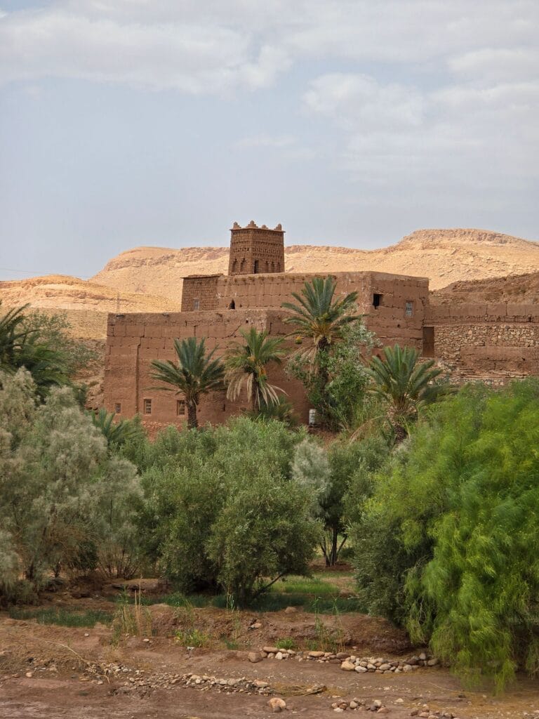
Beyond Fint, the landscape opens toward one of North Africa’s most celebrated cultural routes—the Drâa Valley. Stretching for hundreds of kilometers through southern Morocco, this immense river valley linked the High Atlas to the Sahara for centuries, carrying caravans, ideas, languages, architecture, and Amazigh traditions across the desert frontier.
Few landscapes in Morocco illustrate the relationship between geography, civilization, and human resilience as vividly as the Drâa Valley. Extending for more than 1,000 kilometers from the southern slopes of the High Atlas toward the Sahara, the Drâa River forms Morocco’s longest river system. Although large sections of its course are now seasonal because of climate and water regulation, the valley it created has supported human settlement for thousands of years.
For travelers leaving Ouarzazate, the Drâa Valley unfolds as a breathtaking sequence of palm groves, fortified villages (ksour), monumental kasbahs, cultivated terraces, and dramatic desert landscapes. Yet its importance extends far beyond scenery. Historically, the valley functioned as one of North Africa’s principal corridors connecting the Mediterranean world with sub-Saharan Africa. Along this route flowed gold, salt, manuscripts, textiles, spices, dates, livestock, religious ideas, artistic traditions, and linguistic influences.
To understand Ouarzazate fully, one must understand the Drâa Valley. The city’s prosperity, political influence, and cultural richness were inseparable from the commercial networks that passed through this remarkable landscape.
Geography: The Valley That Connected Worlds
The Drâa River begins where the Dades and Ouarzazate Rivers converge near the El Mansour Eddahbi Reservoir south of Ouarzazate. From there, it winds through mountain foothills, fertile oases, rocky plateaus, and increasingly arid desert landscapes before eventually disappearing into the sands of the Sahara during much of the year.
Although modern maps emphasize national boundaries, historical geography viewed the Drâa Valley differently. Rather than dividing regions, it united them.
The valley linked:
- The High Atlas Mountains.
- The Anti-Atlas.
- The Sous region.
- The Sahara.
- Western Sahel trade routes.
This strategic position transformed the valley into one of Morocco’s most significant transportation and communication corridors for nearly two millennia.
Merchants, scholars, pilgrims, diplomats, craftsmen, nomadic pastoralists, and military expeditions all depended upon its chain of oases for survival.
Without the Drâa Valley, sustained travel across southern Morocco would have been far more difficult, if not impossible.
Human Settlement Since Prehistory
Archaeological investigations demonstrate that the Drâa Valley has attracted human settlement since prehistoric times.
Rock engravings scattered throughout southern Morocco depict cattle, antelopes, ostriches, hunting scenes, geometric symbols, and early pastoral communities, revealing that the region once experienced considerably wetter climatic conditions.
During the early Holocene, much of what is now semi-desert supported grasslands and seasonal lakes capable of sustaining larger populations.
As climate gradually became drier, communities adapted by concentrating around reliable water sources, refining irrigation systems, and developing increasingly sophisticated agricultural practices.
These environmental changes profoundly influenced Amazigh cultural evolution.
Rather than abandoning the region, local populations transformed ecological challenges into opportunities through technological innovation and collective organization.
The emergence of oasis agriculture represents one of humanity’s most successful adaptations to arid environments.
The Rise of Oasis Civilization
The Drâa Valley gave birth to a distinctive form of civilization centered upon oasis communities.
Unlike urban centers dependent upon centralized political institutions, oasis settlements developed through cooperation among farming families responsible for maintaining irrigation networks and defending agricultural land.
Each oasis functioned as a carefully balanced ecological system integrating:
- Water management.
- Palm cultivation.
- Fruit orchards.
- Grain production.
- Animal husbandry.
- Earthen architecture.
- Local craftsmanship.
Because every component depended upon the others, environmental knowledge became inseparable from social organization.
Anthropologists often describe oasis societies as examples of ecological communities in which collective survival required continuous cooperation.
This principle remains visible today in many traditional villages throughout the valley.
The Drâa Valley and the Trans-Saharan Trade Routes
From approximately the eighth century onward, the Drâa Valley assumed growing importance within the trans-Saharan commercial system.
Caravans crossing the desert rarely traveled randomly.
Instead, they followed established routes connecting reliable water sources and defensible settlements.
The Drâa Valley became one of these essential arteries.
Camel caravans transported:
- Gold from West Africa.
- Salt extracted from Saharan mines.
- Ivory.
- Leather.
- Indigo.
- Ostrich feathers.
- Dates.
- Copper.
- Textiles.
- Manuscripts.
- Horses.
- Spices.
Merchants often traveled for several months, moving between cities such as Sijilmasa, Timbuktu, Gao, Marrakech, and eventually Mediterranean ports.
Oases along the Drâa provided food, water, veterinary care for camels, storage facilities, and secure overnight accommodation.
Without these settlements, long-distance trade would have been economically unsustainable.
Cultural Exchange Beyond Commerce
Trade carried much more than merchandise.
The Drâa Valley became a corridor for ideas, beliefs, artistic styles, technologies, and languages.
Islamic scholarship spread alongside commercial activity.
Arabic manuscripts circulated through religious schools.
Amazigh oral traditions continued flourishing within local communities.
Architectural techniques evolved through interactions among mountain builders, Saharan craftsmen, Andalusian refugees, and merchants arriving from distant regions.
Textile motifs, jewelry styles, musical traditions, agricultural innovations, and culinary practices all reflect centuries of cultural exchange.
Historians increasingly reject simplistic narratives portraying the Sahara as a barrier.
Instead, they recognize it as a bridge connecting civilizations through networks in which the Drâa Valley played a central role.
Ksour: Fortified Villages of the Valley
Perhaps the most distinctive architectural feature of the Drâa Valley is its extraordinary concentration of ksour (singular: ksar).
Unlike isolated kasbahs constructed primarily for influential families, ksour were fortified villages housing entire communities.
Their defensive walls protected:
- Residential quarters.
- Mosques.
- Granaries.
- Wells.
- Markets.
- Workshops.
- Communal storage facilities.
Narrow streets minimized exposure to sunlight while improving defense during periods of conflict.
Entrance gates could be secured rapidly whenever danger approached.
Many ksour also incorporated watchtowers from which guards monitored surrounding agricultural lands and caravan routes.
These settlements illustrate how architecture responded simultaneously to environmental, economic, and political challenges.
Amazigh Social Organization Within the Valley
Life throughout the Drâa Valley depended upon cooperation extending beyond individual households.
Village councils regulated irrigation schedules, mediated disputes, organized maintenance of canals, and coordinated agricultural activities.
Collective labor remained essential for repairing flood damage, constructing new channels, harvesting crops, and maintaining defensive walls.
Extended families occupied interconnected residential compounds while preserving considerable autonomy within broader communal structures.
Anthropologists emphasize that these governance systems reflected customary Amazigh legal traditions developed long before centralized state administration reached many remote regions.
Although formal institutions have evolved considerably, elements of these cooperative traditions continue influencing local social organization today.
Traditional Agriculture Along the Drâa
Agriculture within the valley demonstrates remarkable adaptation to environmental constraints.
Farmers organized cultivation according to vertical ecological principles similar to those observed in Skoura.
Date palms formed protective upper canopies.
Fruit trees occupied intermediate layers.
Vegetables and cereals grew beneath filtered sunlight where evaporation remained relatively low.
Traditional crops included:
- Dates.
- Barley.
- Wheat.
- Henna.
- Alfalfa.
- Figs.
- Pomegranates.
- Almonds.
- Olives.
Livestock—including goats, sheep, and donkeys—contributed manure essential for maintaining soil fertility.
Modern agronomists frequently recognize these systems as highly sustainable because they maximize productivity while minimizing environmental degradation.
The Linguistic Landscape of the Drâa Valley
The Drâa Valley also represents one of Morocco’s most fascinating linguistic regions.
For centuries, varieties of Tashelhit (Tachelhit) have served as the dominant indigenous language throughout much of the valley, preserving an exceptionally rich vocabulary associated with agriculture, irrigation, architecture, caravan trade, and oasis ecology.
Arabic gradually expanded through religious scholarship, administration, and commerce, resulting in widespread bilingualism.
Many place names retain ancient Amazigh origins, reflecting remarkable continuity despite political transformations.
Linguists consider the valley especially valuable because oral traditions preserve specialized terminology describing environmental knowledge unavailable in written dictionaries.
This linguistic heritage forms an essential component of the region’s intangible cultural legacy.
Religious and Intellectual Life
The Drâa Valley has long been recognized as a center of Islamic scholarship within southern Morocco.
Numerous zawiyas (religious institutions), Qur’anic schools, and scholarly families contributed to religious education, manuscript production, and legal scholarship.
Yet these institutions developed within Amazigh-speaking societies rather than replacing them.
Religious life therefore illustrates cultural synthesis rather than cultural substitution.
Many scholars combined Islamic learning with local customary knowledge concerning agriculture, water management, conflict resolution, and community leadership.
Historical manuscripts preserved throughout the region document centuries of intellectual exchange linking southern Morocco with cities across North Africa and West Africa.
Challenges Facing the Valley Today
Like many historic cultural landscapes, the Drâa Valley faces significant contemporary pressures.
Climate change has reduced water availability in many areas.
Groundwater extraction has increased agricultural stress.
Young people increasingly migrate toward urban centers seeking education and employment.
Traditional earthen buildings require specialized maintenance that fewer craftsmen now possess.
Tourism creates economic opportunities while also introducing risks of commercialization and architectural alteration.
Conservation specialists increasingly argue that protecting the Drâa Valley requires integrated strategies combining heritage preservation, sustainable agriculture, environmental restoration, and support for local communities.
Without living communities, monuments alone cannot preserve the valley’s cultural significance.
Why the Drâa Valley Matters Today
The Drâa Valley represents far more than a scenic destination.
It demonstrates how Amazigh communities transformed one of North Africa’s most demanding environments into a thriving cultural corridor through cooperation, environmental knowledge, and architectural ingenuity.
Its ksour, kasbahs, palm groves, irrigation systems, oral traditions, and caravan history reveal a civilization that flourished not despite ecological limitations but because generations learned to live within them.
For modern readers, the valley offers valuable lessons about sustainability, resilience, and the enduring relationship between landscape and culture.
In an era of increasing environmental uncertainty, the Drâa Valley reminds us that long-term prosperity depends not upon dominating nature but upon understanding and working with it.
The Valley of Roses: Where Amazigh Agriculture Meets Fragrance, Beauty, and Tradition
The Valley of Roses and the Fragrant Landscapes of Southern Morocco
North of Ouarzazate, another extraordinary valley reveals a different expression of Amazigh environmental knowledge. Every spring, the Valley of Roses (Vallée des Roses) transforms into a mosaic of blooming Damask roses, ancient villages, terraced gardens, and traditional festivals. Here, agriculture, perfume production, women’s cooperatives, and mountain culture combine to create one of Morocco’s most distinctive cultural landscapes.
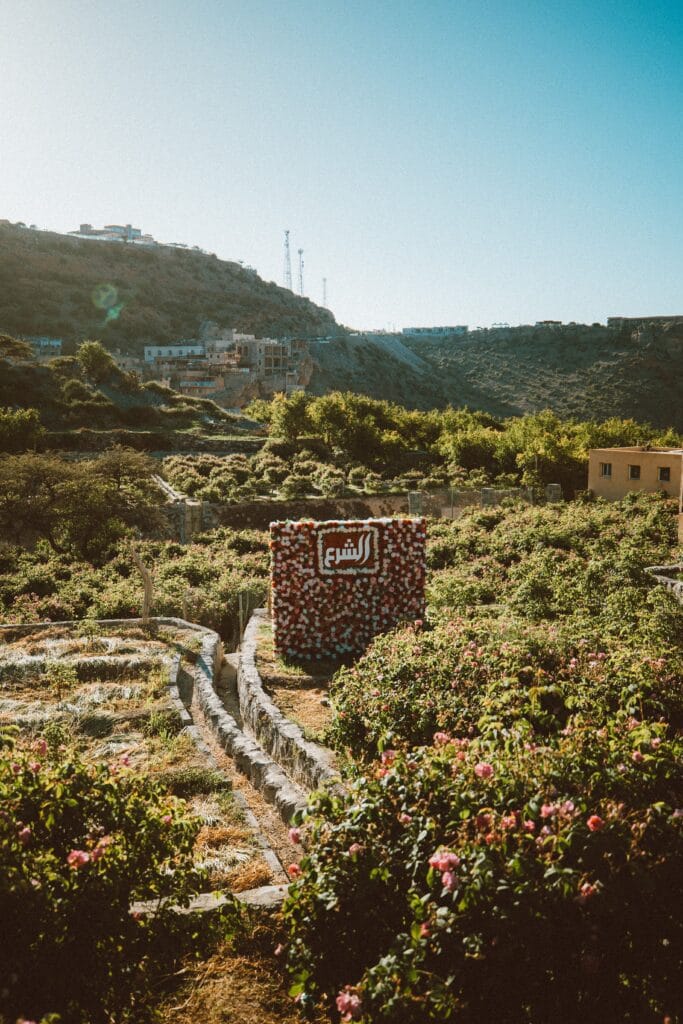
Among the many landscapes surrounding Ouarzazate, few capture the imagination as powerfully as the Valley of Roses (Vallée des Roses), stretching through the fertile valley of M’Goun between the High Atlas Mountains and the gateway to the Sahara. Every spring, this remarkable region transforms into a sea of delicate pink blossoms as thousands of Damask rose bushes bloom against a backdrop of snow-capped peaks, ancient kasbahs, earthen villages, and terraced fields.
To many visitors, the valley appears as one of Morocco’s most beautiful destinations. Yet behind its fragrance lies a much deeper story—one of Amazigh agricultural knowledge, communal labor, environmental adaptation, women’s craftsmanship, and centuries of cultural continuity.
Unlike commercial flower industries developed through mechanized agriculture, the Valley of Roses remains largely rooted in traditional farming practices where cultivation, harvesting, and processing continue to depend upon family cooperation and inherited expertise. The roses themselves have become symbols not only of natural beauty but also of resilience, identity, and sustainable rural livelihoods.
Geography of the Valley
The Valley of Roses is centered around the town of Kelaat M’Gouna, approximately 90 kilometers northeast of Ouarzazate, within the province of Tinghir. It occupies part of the upper M’Goun Valley, where meltwater descending from the High Atlas creates fertile soils capable of supporting orchards, cereal fields, walnut trees, almond groves, and extensive rose cultivation.
The surrounding landscape illustrates one of Morocco’s most striking environmental contrasts.
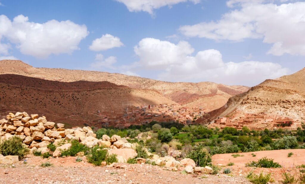
Towering limestone mountains rise above narrow river valleys lined with lush vegetation. Earthen villages blend naturally into the hillsides, while centuries-old kasbahs overlook cultivated terraces nourished by carefully managed irrigation systems.
This ecological diversity has allowed local Amazigh communities to develop agricultural systems capable of producing food, medicinal plants, aromatic flowers, and valuable commercial products despite relatively limited rainfall.
How Roses Arrived in Southern Morocco
The exact history of Damask roses (Rosa damascena) in Morocco remains the subject of scholarly discussion. Many historians suggest that the species reached southern Morocco through medieval trade networks linking North Africa with the eastern Mediterranean and the Middle East, possibly during the Islamic period. Others argue that successive waves of merchants, pilgrims, and scholars contributed to its gradual introduction.
Regardless of its precise origins, the rose found exceptionally favorable conditions within the M’Goun Valley.
Abundant mountain water, fertile alluvial soils, cool winter temperatures, and warm spring sunshine created an ideal environment for cultivation.
Over generations, Amazigh farming communities adapted the plant to local ecological conditions while integrating rose production into existing agricultural systems rather than replacing traditional food crops.
Today, the rose has become so closely associated with the region that it is often regarded as an integral component of its cultural identity.
Amazigh Agricultural Knowledge Behind Rose Cultivation
Although the Valley of Roses attracts visitors primarily during the flowering season, successful cultivation depends upon year-round agricultural expertise.
Farmers carefully prune bushes during winter to encourage vigorous spring growth. Irrigation follows traditional schedules coordinated through communal water management systems inherited from earlier generations.
Organic fertilizers derived from livestock manure continue to play an important role in maintaining soil fertility.
Harvesting occurs during the early morning hours before intense sunlight reduces the concentration of aromatic oils within the petals.
This timing requires remarkable coordination among families, who often begin work before sunrise.
Anthropologists emphasize that such agricultural practices illustrate the broader Amazigh philosophy of working with seasonal rhythms rather than attempting to dominate natural cycles.
Knowledge concerning pruning, irrigation, harvesting, and processing has traditionally been transmitted orally within families, preserving practical expertise accumulated over centuries.
The Rose Harvest: A Collective Celebration
Each spring, usually between late April and mid-May, villages throughout the valley enter one of the busiest periods of the agricultural calendar.
Entire families participate in harvesting.
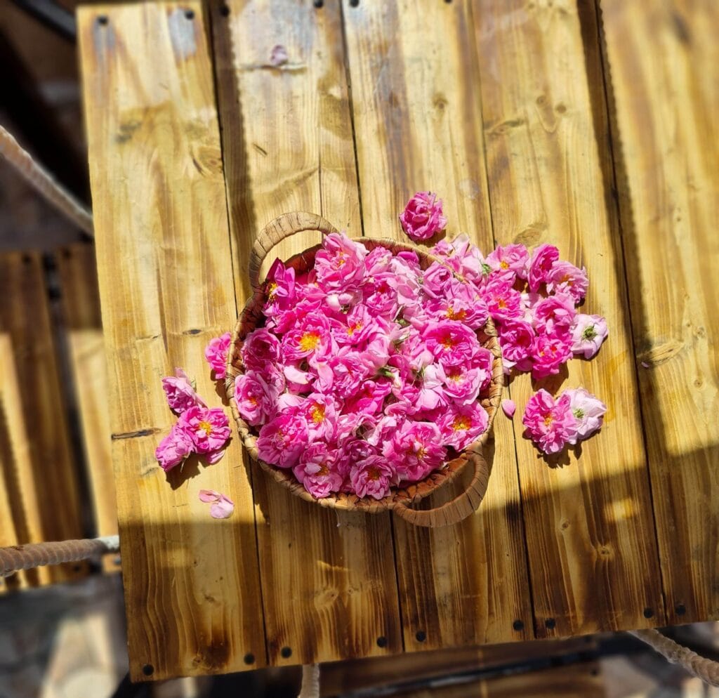
Women, men, and children gather thousands of blossoms by hand, placing them carefully into woven baskets before transporting them for processing.
The atmosphere combines labor with celebration.
Traditional songs accompany the harvest.
Families prepare communal meals for workers.
Neighbors frequently assist one another, reinforcing longstanding traditions of mutual cooperation.
Because rose petals deteriorate rapidly after collection, harvesting must proceed efficiently.
Fresh blossoms are delivered the same day to local cooperatives and distillation facilities where they are transformed into rose water, essential oils, cosmetics, soaps, perfumes, and medicinal preparations.
The harvest therefore represents both an agricultural activity and an important cultural event strengthening community relationships.
Women’s Cooperatives and Rural Development
Perhaps no aspect of the Valley of Roses better illustrates contemporary Amazigh resilience than the emergence of women’s cooperatives.
During recent decades, numerous cooperatives have enabled rural women to participate more directly in processing and marketing locally produced goods.
These organizations produce:
- Rose water.
- Essential oils.
- Natural cosmetics.
- Handmade soaps.
- Herbal preparations.
- Culinary products.
- Traditional beauty treatments.
Beyond generating income, cooperatives strengthen social networks, encourage education, preserve artisanal knowledge, and promote sustainable rural development.
Many also welcome visitors interested in learning about traditional distillation techniques, medicinal plant uses, and Amazigh cultural heritage.
Researchers studying rural development frequently cite these cooperatives as successful examples of combining cultural preservation with economic empowerment.
Traditional Distillation Techniques
The fragrance of the Valley of Roses owes much to traditional methods of extraction refined across generations.
Fresh petals are placed within copper distillation vessels where gentle heating separates aromatic compounds from plant material.
Steam carrying fragrant oils condenses into rose water while smaller quantities of concentrated essential oil are collected through careful separation.
Because producing a single kilogram of pure rose essential oil requires several tons of fresh petals, genuine rose oil remains among the world’s most valuable natural aromatic products.
Traditional distillation emphasizes patience rather than speed.
Experienced artisans carefully regulate temperature and timing to preserve the delicate chemical composition responsible for the flower’s characteristic fragrance.
Although modern equipment is increasingly available, many producers continue employing techniques closely resembling those used by earlier generations.
The Rose Festival: Celebrating Heritage
Each year, Kelaat M’Gouna hosts the internationally renowned Rose Festival, attracting visitors from across Morocco and around the world.
The festival marks the conclusion of the harvest while celebrating the region’s agricultural heritage.
Events typically include:
- Traditional Amazigh music.
- Ahwach dance performances.
- Artisan exhibitions.
- Agricultural displays.
- Cultural processions.
- Local food markets.
- Beauty pageants inspired by regional traditions.
- Educational exhibitions concerning rose cultivation.
Although tourism has expanded the festival’s visibility, its deeper significance lies in reinforcing communal identity and expressing gratitude for a successful harvest.
Anthropologists interpret such celebrations as examples of agricultural festivals through which communities reaffirm relationships with both the natural environment and their shared cultural traditions.
Architecture of the Valley
The Valley of Roses is equally remarkable for its architecture.
Earthen kasbahs rise above cultivated fields, while fortified villages continue to reflect centuries of Amazigh building traditions.
Construction techniques resemble those found throughout southern Morocco:
- Rammed-earth walls.
- Adobe bricks.
- Decorative geometric façades.
- Flat roofs.
- Interior courtyards.
- Wooden ceilings constructed from regional timber.
These buildings were carefully adapted to mountain climates where winter temperatures may fall below freezing while summers remain warm and dry.
Their thermal performance continues to impress contemporary architects seeking environmentally sustainable construction methods.
Together with the surrounding agricultural landscape, they create one of Morocco’s most harmonious examples of cultural architecture integrated with nature.
Biodiversity and Sustainable Agriculture
The Valley of Roses supports remarkable biological diversity extending beyond cultivated flowers.
Traditional farming systems include:
- Walnut trees.
- Almond orchards.
- Olive groves.
- Fruit trees.
- Medicinal herbs.
- Native grasses.
- Pollinating insects.
- Migratory birds.
Farmers historically avoided monoculture by integrating multiple crops within carefully managed irrigation systems.
This diversity improves soil health, reduces vulnerability to pests, and strengthens resilience against climatic variability.
Environmental researchers increasingly recognize such practices as important examples of agroecological sustainability developed long before modern environmental science.
Climate Change and the Future of the Valley
Like many mountain agricultural regions, the Valley of Roses faces significant environmental challenges.
Changes in snowfall patterns within the High Atlas affect water availability during the growing season.
Increasing temperatures influence flowering periods and harvest timing.
Population changes and rural migration reduce the availability of traditional agricultural labor.
Meanwhile, expanding tourism creates both opportunities and pressures.
Conservation specialists emphasize that preserving the valley requires integrated approaches supporting:
- Sustainable water management.
- Traditional irrigation systems.
- Local farming communities.
- Heritage architecture.
- Biodiversity conservation.
- Responsible tourism.
Without maintaining these interconnected systems, the valley risks losing both its ecological balance and cultural authenticity.
Why the Valley of Roses Matters
The Valley of Roses demonstrates that beauty alone does not explain cultural significance.
Its fragrance reflects generations of ecological knowledge, agricultural cooperation, artisanal craftsmanship, and Amazigh resilience.
Every rose harvested represents centuries of inherited experience concerning climate, water, soil, community organization, and sustainable land management.
For visitors, the valley offers unforgettable landscapes.
For scholars, it provides a living laboratory illustrating relationships among agriculture, architecture, economy, gender, and environmental adaptation.
For Morocco, it stands as one of the country’s most distinctive cultural landscapes, where natural beauty and human creativity continue to flourish together.
The Valley of Roses reminds us that heritage is not confined to monuments carved in stone. Sometimes it blooms quietly each spring in fields carefully tended by communities whose knowledge has been cultivated across countless generations.
Did You Know? – Fascinating Facts About Aït Ben Haddou
- Ouarzazate’s name is commonly believed to derive from Amazigh (Berber) roots and is often interpreted as meaning “without noise” or “without confusion,” reflecting the calm atmosphere of this desert region.
- Aït Ben Haddou has been continuously inhabited for centuries and remains one of the finest surviving examples of a fortified earthen ksar in North Africa.
- The entire Skoura Oasis contains thousands of palm trees and numerous historic kasbahs, many of which are still inhabited today.
- Kasbah Taourirt once served as one of the principal administrative centers of the powerful Glaoua family during the late nineteenth and early twentieth centuries.
- Traditional Amazigh builders created thick earthen walls that naturally keep interiors cool during hot summer days and warm during cold desert nights—an early form of passive climate control.
- The Drâa Valley contains one of Morocco’s longest river systems, supporting oasis settlements that have flourished for many centuries despite the surrounding desert.
- The famous Valley of Roses produces thousands of tons of Damask roses each spring, supplying Morocco’s perfume, cosmetic, and essential oil industries.
- Fint Oasis remains one of the least-known oasis landscapes near Ouarzazate despite being located only a short drive from the city.
- Ouarzazate has hosted the filming of dozens of internationally recognized productions, making it one of Africa’s most important cinematic destinations.
- Amazigh irrigation systems found throughout southern Morocco continue to inspire researchers studying sustainable water management in arid environments.
Frequently Asked Questions About Aït Ben Haddou
Is Aït Ben Haddou part of Ouarzazate?
Yes. Aït Ben Haddou is located about 30 kilometers northwest of Ouarzazate and is one of the region’s most important historical attractions. The fortified ksar has been recognized as a UNESCO World Heritage Site since 1987.
What is the difference between a kasbah and a ksar?
A kasbah is generally a fortified residence or fortress built for an influential family or local ruler, while a ksar is a fortified village containing multiple homes, streets, communal spaces, and often a mosque and granaries surrounded by defensive walls.
Why is Aït Ben Haddou considered unique?
Aït Ben Haddou is regarded as one of the world’s finest examples of traditional earthen architecture. Its remarkably preserved defensive walls, towers, and communal buildings illustrate centuries of Amazigh architectural knowledge adapted to desert environments.
What can visitors see at Kasbah Taourirt?
Visitors can explore decorated reception rooms, defensive towers, courtyards, storage areas, intricate earthen architecture, carved wooden ceilings, and historic spaces that once served as the political headquarters of the Glaoua family.
What is special about Skoura Oasis?
Skoura Oasis is one of Morocco’s largest palm groves and is renowned for its traditional irrigation systems, fertile agricultural landscape, historic kasbahs, and sustainable oasis farming practices developed over centuries.
Why is Kasbah Amridil important?
Kasbah Amridil is among Morocco’s best-preserved earthen kasbahs. It showcases traditional Amazigh domestic architecture and offers valuable insight into agricultural life, environmental adaptation, and oasis society in southern Morocco.
What makes Fint Oasis different from other Moroccan oases?
Fint Oasis is hidden within a rocky canyon just outside Ouarzazate, creating a striking contrast between barren desert hills and lush vegetation. Its isolation has helped preserve traditional Amazigh villages, local customs, and peaceful natural surroundings.
Why is the Drâa Valley historically significant?
The Drâa Valley was one of the principal corridors connecting Morocco with sub-Saharan Africa. For centuries, caravans transported gold, salt, textiles, spices, manuscripts, and other goods through this fertile oasis network.
What is the Valley of Roses known for?
The Valley of Roses is internationally recognized for cultivating Damask roses, producing rose water and essential oils, and hosting the annual Rose Festival, which celebrates local agriculture, Amazigh traditions, and rural craftsmanship.
How did Amazigh communities adapt to the desert climate?
They developed sophisticated irrigation systems, built thick earthen houses for natural insulation, cultivated multi-layered oasis agriculture, and organized communities around collective resource management that ensured long-term sustainability.
Is Aït Ben Haddou suitable for cultural tourism?
Absolutely. Aït Ben Haddou is one of Morocco’s richest destinations for cultural tourism, offering visitors opportunities to explore UNESCO heritage, Amazigh traditions, archaeological sites, historic architecture, local crafts, and authentic rural communities.
How many days should visitors spend in Aït Ben Haddou?
Three to five days is ideal for exploring Aït Ben Haddou, Kasbah Taourirt, Skoura Oasis, Kasbah Amridil, Fint Oasis, the Drâa Valley, nearby film studios, and surrounding mountain landscapes without rushing.
Is Aït Ben Haddou good for photographers?
Yes. Aït Ben Haddou offers exceptional photography opportunities thanks to its dramatic desert scenery, earthen architecture, mountain backdrops, palm groves, sunrise and sunset light, and vibrant traditional villages.
What role did Aït Ben Haddou play in trans-Saharan trade?
Its strategic location allowed merchants traveling between North Africa and sub-Saharan Africa to rest, exchange goods, and access water, making the region an important commercial and cultural crossroads for centuries.
Why is earthen architecture still relevant today?
Traditional earthen buildings naturally regulate indoor temperatures, use locally available materials, require relatively low energy to construct, and offer valuable lessons for sustainable architecture in dry climates.
Can travelers visit all these heritage sites independently?
Most sites are accessible by car, and many can be explored independently. However, hiring a knowledgeable local guide can greatly enhance the experience by providing historical context, architectural insights, and cultural interpretation.
Why should Ouarzazate be included in every Morocco itinerary?
Ouarzazate combines spectacular landscapes, UNESCO World Heritage monuments, Amazigh culture, historic caravan routes, traditional architecture, fertile oases, and living cultural traditions within a single region. Few destinations in Morocco offer such a rich combination of history, nature, and authentic cultural experiences.
Conclusion: Aït Ben Haddou—Where Morocco’s Past Continues to Shape Its Future
Aït Ben Haddou is far more than a gateway to the Sahara or a backdrop for internationally acclaimed films. It is one of Morocco’s most remarkable cultural landscapes, where history, architecture, ecology, and Amazigh traditions have evolved together over many centuries. From the fortified walls of Aït Ben Haddou and the political legacy of Kasbah Taourirt to the fertile palm groves of Skoura, the hidden serenity of Fint Oasis, the ancient caravan routes of the Drâa Valley, and the fragrant landscapes of the Valley of Roses, each place contributes a unique chapter to the story of southern Morocco.
Together, these sites demonstrate how Amazigh communities transformed challenging environments into thriving centers of settlement, agriculture, commerce, and culture. Their earthen architecture reflects an extraordinary understanding of climate adaptation, while traditional irrigation systems reveal sophisticated knowledge of water management in arid landscapes. The social organization of ksour and kasbahs illustrates how cooperation, collective responsibility, and environmental stewardship enabled communities to flourish long before the emergence of modern infrastructure.
These landscapes are also living repositories of intangible heritage. Local languages, oral traditions, music, craftsmanship, seasonal festivals, and agricultural practices continue to connect present-day communities with generations of ancestors who shaped this remarkable region. Visiting Aït Ben Haddou therefore offers more than beautiful scenery—it provides an opportunity to understand how culture and landscape have continuously influenced one another across centuries.
Today, preserving this heritage has become increasingly important. Climate change, changing lifestyles, rural migration, and the pressures of tourism all present challenges that require careful conservation and sustainable development. Protecting Aït Ben Haddou kasbahs, oases, valleys, and traditional knowledge ensures that future generations will continue to learn from one of North Africa’s most outstanding examples of human adaptation and cultural resilience.
Whether you come to admire UNESCO-listed monuments, explore ancient caravan routes, discover Amazigh heritage, photograph spectacular landscapes, or simply experience authentic Moroccan culture, Aït Ben Haddou rewards every visitor with a journey through history that remains alive. It is a place where earth becomes architecture, water becomes civilization, and tradition continues to inspire the future.
References (APA 7th Edition)
Adam, A. (1972). Casablanca: Essai sur la transformation de la société marocaine au contact de l’Occident. CNRS.
Bianca, S. (2000). Urban Form in the Arab World. Thames & Hudson.
Bourouiba, R. (1981). L’Art Religieux Musulman en Algérie. SNED.
Cressier, P. (Ed.). (2010). Le Maroc Médiéval. Casa de Velázquez.
Eickelman, D. F. (1976). Moroccan Islam: Tradition and Society in a Pilgrimage Center. University of Texas Press.
El Faïz, M. (2005). L’Eau et les Systèmes Hydrauliques Traditionnels au Maroc. Wallada.
Fagan, B. M. (2014). The Great Warming. Bloomsbury.
García-Arenal, M. (Ed.). (2012). The Western Mediterranean and the Islamic World. Ashgate.
Geertz, C. (1979). Meaning and Order in Moroccan Society. Cambridge University Press.
Gellner, E. (1969). Saints of the Atlas. University of Chicago Press.
Harris, W. (1898). Morocco That Was. William Blackwood.
Ilahiane, H. (2006). Historical Dictionary of the Berbers (Imazighen). Scarecrow Press.
Lightfoot, D. R. (1996). Moroccan khettara: Traditional irrigation and progressive desiccation. Geoforum, 27(2), 261–273.
Marçais, G. (1954). L’Architecture Musulmane d’Occident. Arts et Métiers Graphiques.
Miller, S. G. (2013). A History of Modern Morocco. Cambridge University Press.
Montagne, R. (1930). Les Berbères et le Makhzen dans le Sud du Maroc. Alcan.
Naji, S. (2001). Art et Architectures Berbères du Maroc. Edisud.
Naji, S. (2009). Greniers Collectifs de l’Atlas. Actes Sud.
Pennell, C. R. (2013). Morocco: From Empire to Independence. Oneworld Publications.
Rachik, H. (2016). Le Proche et le Lointain. Centre Jacques-Berque.
Rivers, T. (2010). Moroccan Cities. Routledge.
Terrasse, H. (1938). Histoire du Maroc. Casablanca.
Terrasse, H. (1968). Kasbas Berbères de l’Atlas et des Oasis. Éditions Atlantides.
UNESCO. (1987). Ksar of Aït Ben Haddou. World Heritage Centre.
UNESCO. (2023). Earthen Architecture Programme. UNESCO World Heritage Centre.
Wilbaux, Q. (2001). La Médina de Marrakech. ACR Édition.
Wilbaux, Q. (2008). La Kasbah de Taourirt. ACR Édition.
Further Reading
For readers who wish to explore the history, architecture, archaeology, and cultural landscapes of Ouarzazate in greater depth, the following resources are particularly valuable:
- UNESCO World Heritage Centre — Ksar of Aït Ben Haddou
- UNESCO Earthen Architecture Programme
- ICOMOS reports on earthen architecture conservation
- Getty Conservation Institute publications on earthen heritage
- Ministry of Youth, Culture and Communication (Morocco) publications on architectural heritage
- Centre Jacques-Berque (Rabat) research publications
- Institut National des Sciences de l’Archéologie et du Patrimoine (INSAP)
- Academic studies on Amazigh architecture, oasis agriculture, and traditional irrigation systems
- Research on sustainable earthen architecture in North Africa
- Anthropological studies of Amazigh communities in southern Morocco