
Middle Atlas Mountains: Geography, Amazigh Culture, Traditions & Living Heritage
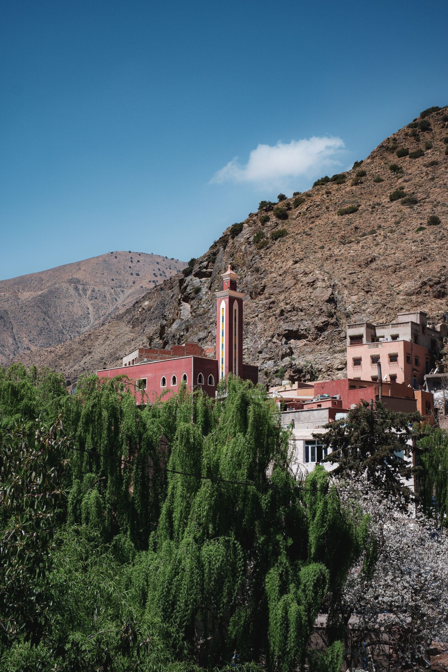
Introduction: Where Forests, Water, and Amazigh Memory Meet
There is a part of Morocco where mountains do not announce themselves through sheer altitude alone.
They appear instead through forests of ancient cedar, limestone plateaus, volcanic landscapes, cold springs, deep valleys, seasonal pastures, crater-like lakes, and villages whose rhythms have long been connected to livestock, agriculture, water, and the changing seasons.
This is the Middle Atlas Mountain region.
Situated between Morocco’s northern plains and the higher mountain landscapes farther south, the Middle Atlas possesses a character distinctly different from the High Atlas. Its identity is shaped less by extreme elevation and more by the interaction of forests, plateaus, karst formations, volcanic activity, water systems, pastoral landscapes, and centuries of human adaptation.
For travelers, the region can seem deceptively quiet. A road through the cedar forests may appear at first to be simply a beautiful journey between cities. A mountain village may seem like another picturesque settlement. A woven carpet may appear to be an attractive handicraft.
Yet beneath these visible landscapes lies a much deeper cultural system.
Middle Atlas Mountain has been inhabited, cultivated, crossed, grazed, narrated, and remembered by communities whose histories are closely connected with Amazigh languages and social traditions. In many parts of the region, mountains are not merely physical barriers. They are territories of belonging.
Pastoral routes, springs, forests, agricultural land, village territories, seasonal movement, marriage networks, local markets, religious traditions, weaving practices, oral memory, and systems of communal organization have historically connected people to the landscape.
Understanding the Middle Atlas therefore requires more than a travel itinerary.
It requires looking at the region simultaneously through geography, geology, archaeology, anthropology, history, ecology, linguistics, and cultural heritage.
Recent geological research illustrates just how complex the physical foundation of the region is. The Middle Atlas contains major karst landscapes, fault systems, carbonate plateaus, and a significant volcanic province associated with Plio-Quaternary activity.
At the same time, environmental research from Lake Iffer has reconstructed approximately 8,000 years of climatic and human influence on the region’s vegetation, demonstrating that today’s Middle Atlas landscapes are the product of a long interaction between environmental change and human activity.
This makes the Middle Atlas especially fascinating.
It is neither simply a wilderness nor simply a cultural landscape.
It is a living interaction between mountains and people.
And to understand it properly, we must first understand the physical geography that made this human history possible.
Table of Contents
What Is the Middle Atlas Mountain Region?
A Distinct Mountain System Within Morocco
The Middle Atlas is one of the major mountain regions of Morocco’s Atlas Mountains and forms an important component of the country’s broader Atlas system.
Unlike the High Atlas mountain, which is famous for its exceptionally high summits and dramatic alpine environments, the Middle Atlas is characterized by a combination of plateaus, limestone massifs, folded mountain structures, volcanic landscapes, forests, valleys, and extensive pastoral areas.
Geologically, the region is not a simple continuous wall of mountains.
It is structurally complex.
Researchers generally distinguish two major structural domains:
- the Tabular or Causse Middle Atlas, and
- the Folded Middle Atlas.
These domains are separated by the major Northern Middle Atlas Fault system.
This distinction is important because it explains why the landscape can change dramatically over relatively short distances.
One moment you may be traveling across a broad limestone plateau; farther south or east, the landscape can become more strongly folded, dissected, volcanic, or deeply incised by valleys.
The Middle Atlas is therefore best understood as a complex geological and ecological mosaic, rather than as one uniform mountain block.
The Position of the Middle Atlas Mountain
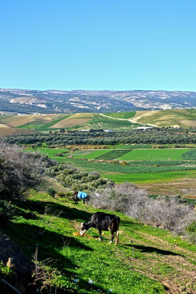
The Middle Atlas occupies a strategic geographical position in central and northern Morocco.
Its landscapes connect several major geographical environments, including the regions around:
- Fez and the Saïs plain;
- Meknes and the northern Moroccan interior;
- Ifrane and Azrou;
- Boulemane;
- Midelt and the High Moulouya;
- Khenifra;
- Beni Mellal and surrounding areas.
The precise boundaries of the Middle Atlas can vary depending on whether the discussion is geographical, geological, ecological, administrative, or cultural.
This is an important point for serious readers.
There is no single universally applicable line on a map that separates the Middle Atlas from every neighboring landscape.
Mountain systems are often defined differently by geologists, geographers, ecologists, historians, and local communities.
Nevertheless, the Middle Atlas is broadly positioned between the Rif and northern Moroccan plains to the north and the High Atlas and High Moulouya environments to the south. Scientific studies commonly describe it as a NE–SW-oriented mountain belt and identify the South-Rifain corridor to the north and the High Atlas/High Moulouya to the south.
That geographical position has had enormous historical consequences.
The Middle Atlas is not an isolated mountain island.
It has long functioned as a zone of passage and interaction between northern Morocco, central Morocco, and the interior mountain and plateau regions.
The Geography of the Middle Atlas Mountain
A Landscape of Plateaus, Valleys, Forests, and Basins
The geography of the Middle Atlas is one of its greatest distinguishing characteristics.
Where the High Atlas often evokes sharp peaks and deep high-altitude valleys, the Middle Atlas frequently presents a more spacious landscape.
Its plateaus can extend across considerable distances.
Its forests can create enormous green horizons.
Its valleys can suddenly open toward agricultural basins.
And its limestone terrain has created an extraordinary variety of caves, springs, sinkholes, underground drainage systems, and karst formations.
This combination gives the Middle Atlas an unusual visual character.
It is simultaneously mountainous and open.
Forested and pastoral.
Wet in some places and semi-arid in others.
Ancient in its geological foundations yet continually transformed by contemporary environmental pressures.
The Tabular Middle Atlas Mountain
The northern and northwestern portion includes extensive plateau-like formations commonly described as the Tabular Middle Atlas or Middle Atlas Causse.
The term “Causse” is associated with limestone plateau landscapes.
These environments are particularly important for understanding the hydrology of the region.
Limestone is highly susceptible to dissolution by water. Over geological time, this can produce:
- caves;
- sinkholes;
- underground channels;
- springs;
- depressions;
- limestone pavements;
- subterranean drainage systems.
The result is a landscape in which water may disappear underground and re-emerge elsewhere.
For people living in such environments, understanding springs and seasonal water availability was historically essential.
The physical geography therefore influenced not only settlement but also agricultural and pastoral strategies.
The Folded Middle Atlas Mountain
South and southeast of the tabular domain lies the Folded Middle Atlas, a structurally different landscape characterized by folds, ridges, basins, and fault-controlled geological structures.
Scientific investigations describe the Middle Atlas as an intracontinental mountain belt and emphasize the importance of inherited fault systems in its geological development.
This structural complexity is not merely a matter for geologists.
It helps explain the region’s:
- relief;
- drainage;
- groundwater systems;
- agricultural zones;
- settlement patterns;
- geological resources;
- and distinctive landscapes.
In other words, the geography beneath the villages has helped shape the geography of human life above them.
A Geological Landscape Far Older Than Human Memory
The Middle Atlas and the Ancient Tethys
The modern Middle Atlas Mountain is the product of a very long geological history.
Long before Amazigh-speaking communities inhabited these landscapes, long before the Roman period, and long before Morocco became a modern state, the region experienced major changes in sea level, sedimentation, tectonic movement, volcanism, and erosion.
During the Mesozoic, parts of what is now Morocco were influenced by the complex geological environments associated with the opening and evolution of the Atlantic and the Tethyan realm.
The Jurassic history of the Atlas region is particularly important.
Sedimentary basins developed, marine environments covered portions of the region, and thick sequences of limestone and other rocks were deposited.
Later tectonic processes transformed these older structures.
Research into the Jurassic evolution of the Middle and High Atlas junction demonstrates how changing tectonic regimes affected sedimentary environments and basin development.
The mountains that you see today are therefore not simply “old mountains.”
They are the visible result of multiple geological chapters superimposed upon one another.
Why the Middle Atlas Mountain Has So Many Volcanic Landscapes
One of the most fascinating features of the Middle Atlas is its volcanic heritage.
The region contains one of Morocco’s important young volcanic provinces.
Research identifies extensive basaltic volcanism during the Miocene to Plio-Pleistocene, producing volcanic cones, lava flows, maars, and other volcanic landforms.
This geological history helps explain landscapes that might otherwise seem surprising in Morocco.
The Middle Atlas is not only a world of limestone and cedar.
It also contains traces of relatively recent volcanic activity.
Volcanic Cones and Maars
Among the region’s distinctive volcanic features are maar-type formations, volcanic depressions associated with explosive interaction between magma and groundwater.
The Azrou–Timahdite Plateau is particularly significant in this respect.
Researchers have noted the unusual variety of volcanic morphology in this area and its relationship with abundant water resources, including lakes, rivers, and groundwater systems.
For visitors, these landscapes can look almost deceptively peaceful.
A volcanic depression may become a lake.
A lava field may become grazing land.
A volcanic slope may become covered by vegetation.
The geological event disappears from human memory while its physical architecture remains.
Water: The Hidden Architecture of the Middle Atlas
Why Water Matters More Than the Mountains Themselves
If forests are among the most recognizable features of the Middle Atlas Mountain, water may be its most consequential.
The region contains important springs, lakes, rivers, groundwater systems, and karstic aquifers.
The relationship between geology and water is particularly important because limestone formations can store and transmit groundwater through fractures, cavities, and underground channels.
Recent hydrogeological research has shown that the Middle Atlas contains highly complex groundwater systems involving carbonate formations, faults, different groundwater ages, and multiple flow pathways.
This means that the Middle Atlas is not merely a mountainous landscape.
It is also a hydrological system.
Water emerging from the mountains has historically supported agriculture and settlements far beyond the immediate mountain zone.
This gives the Middle Atlas importance not only for local communities but also for surrounding plains and downstream populations.
The Lakes of the Middle Atlas Mountain
The Middle Atlas is famous for its mountain lakes and wetlands.
Among the best-known are:
- Dayet Aoua;
- Dayet Ifrah;
- Dayet Iffer;
- Aguelmame Sidi Ali;
- Aguelmame Azigza;
- and numerous smaller seasonal or permanent water bodies.
These lakes are not interchangeable.
Each has its own geological setting, ecological characteristics, hydrological history, and relationship with nearby communities.
Their importance extends beyond tourism.
They provide habitats for aquatic organisms and birds, contribute to local hydrological systems, and historically supported pastoral landscapes.
Lake Iffer and the Memory of the Environment
Lake Iffer is particularly interesting from a scientific perspective because sediments preserved in the lake provide a record of environmental change.
A 2025 palynological study reconstructed approximately 8,000 years of vegetation history and human influence in the Middle Atlas using sediments from Lake Iffer.
The evidence indicates that vegetation composition changed over thousands of years.
Pine was dominant during earlier phases, while more drought-tolerant vegetation expanded later.
The study also identifies increasing human influence on forest landscapes during the later Holocene.
This kind of evidence changes how we understand the Middle Atlas.
A forest seen today may look timeless.
But scientific evidence shows that mountain ecosystems have histories.
They expand.
They contract.
They adapt.
They are altered by climate.
And they are transformed by people.
The Middle Atlas Mountain landscape that you photograph today is therefore a snapshot in a much longer environmental story.
The Cedar Forests: More Than a Beautiful Landscape
The Atlas Cedar
Few trees are as strongly associated with the Middle Atlas Mountain as the Atlas cedar (Cedrus atlantica).
The cedar forests around areas such as Azrou and Ifrane have become among the most recognizable landscapes of central Morocco.
But reducing them to a tourist attraction would miss their deeper ecological and cultural importance.
The cedar is part of a larger forest ecosystem involving other plant species, wildlife, soils, water cycles, grazing practices, and human use.
The forests have historically supplied resources including timber, fuel, shade, grazing environments, and materials.
They have also been affected by pressures such as:
- overgrazing;
- wood extraction;
- drought;
- climate change;
- changing land-use patterns;
- and demographic pressures.
The future of the Middle Atlas Mountain cannot therefore be separated from the future of its forests.
The Middle Atlas as an Ecological Transition Zone
The Middle Atlas occupies a geographical position where several climatic influences interact.
Atlantic influences affect western areas.
Mediterranean influences are important farther north.
Continental conditions become increasingly pronounced toward the interior.
Elevation modifies temperature and precipitation.
As a result, the Middle Atlas Mountain contains remarkable ecological variation.
This variation is one reason why the region can support forests, agricultural systems, pastoral landscapes, wetlands, and semi-arid environments within relatively limited geographical distances.
The mountains act as both barrier and bridge.
They obstruct certain climatic flows while facilitating others.
They collect precipitation.
They store water.
They divide watersheds.
And they create ecological niches.
The Human History of the Middle Atlas Mountain
Before Modern Borders
The Middle Atlas should not be interpreted through modern administrative boundaries alone.
Human movement through the mountains predates the modern Moroccan state by many centuries.
People moved according to:
- pasture;
- water;
- agricultural opportunities;
- trade;
- seasonal migration;
- political alliances;
- marriage;
- pilgrimage;
- markets;
- and conflict.
The mountain landscape was therefore a social geography.
Different communities controlled or negotiated access to particular territories.
Seasonal grazing routes connected lowlands and uplands.
Markets connected mountain communities with towns.
And oral traditions preserved memories of places, ancestors, conflicts, agreements, and sacred landscapes.
Amazigh Communities of the Middle Atlas Mountain
A Mountain Region Where Amazigh Culture Remains Deeply Rooted
The Middle Atlas Mountain is one of the most important regions for understanding Morocco’s Amazigh heritage.
Several Amazigh-speaking communities have historically inhabited the region, particularly communities associated with Central Atlas Tamazight.
However, it is important not to treat “Middle Atlas Amazigh culture” as a single uniform culture.
Different tribes, confederations, villages, families, and local communities possess distinct histories and traditions.
Language varieties differ.
Carpet designs differ.
Musical traditions differ.
Settlement patterns differ.
Pastoral practices differ.
Even the interpretation of particular symbols may vary from one community to another.
This internal diversity is one of the most important characteristics of Amazigh culture in Morocco.
Central Atlas Tamazight and Mountain Identity
Language provides another way of understanding the region.
Central Atlas Tamazight is one of the major Amazigh linguistic varieties of Morocco.
Historically, language functioned not simply as a means of communication but also as a vehicle for:
- oral history;
- poetry;
- genealogical memory;
- proverbs;
- songs;
- ecological knowledge;
- pastoral terminology;
- social relationships;
- and local concepts of place.
A mountain landscape therefore has a linguistic dimension.
Names for springs, valleys, grazing areas, plants, animals, geological formations, and settlements can preserve knowledge that is invisible on modern maps.
This is why linguistic documentation is important for cultural heritage.
When a traditional place-name disappears, an element of geographical memory may disappear with it.
The Middle Atlas and Amazigh Oral Tradition
Written archives do not contain the whole history of the Middle Atlas.
For many rural communities, oral transmission has historically been crucial.
Stories can preserve memories of:
- ancestors;
- saints;
- tribal migration;
- territorial disputes;
- droughts;
- exceptional winters;
- battles;
- marriages;
- heroic figures;
- religious events;
- and relationships with neighboring communities.
Poetry and song can perform similar functions.
A society does not need a written chronicle to possess historical consciousness.
Its history may be embedded in performance.
This is especially important when studying mountain communities whose historical experiences were not always recorded extensively in state archives.
Pastoralism and the Seasonal Movement of People
Transhumance in the Middle Atlas Mountain
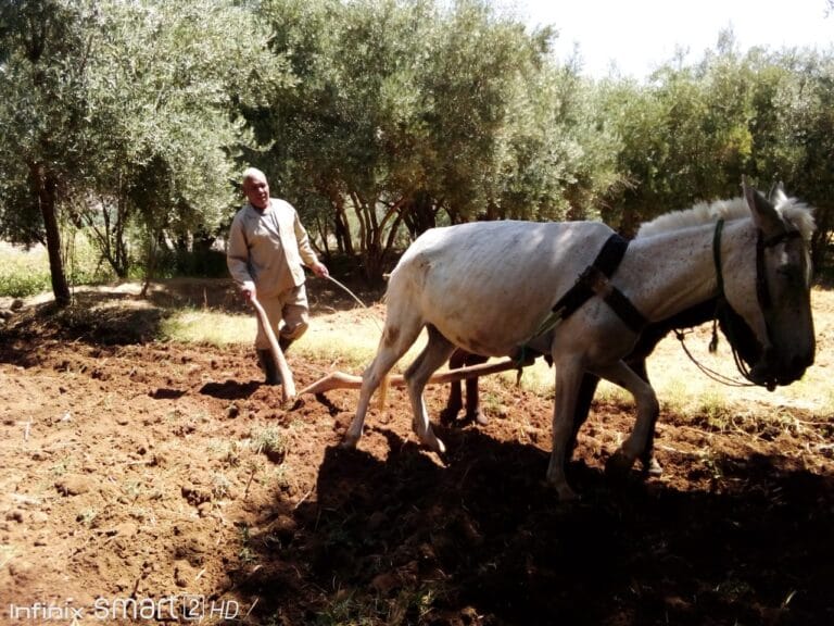
One of the most important themes in understanding traditional Middle Atlas society is pastoral mobility.
For communities dependent partly on livestock, the mountain environment was not simply divided into “village” and “wilderness.”
It was a seasonal landscape.
Different elevations and ecological zones could become useful at different times of the year.
This encouraged forms of mobility associated with:
- sheep;
- goats;
- cattle;
- horses;
- and other livestock.
Pastoral movement was not random wandering.
It required knowledge.
People needed to understand:
- water sources;
- grazing conditions;
- weather;
- seasonal vegetation;
- terrain;
- animal health;
- property boundaries;
- and relationships with neighboring groups.
This knowledge constituted a sophisticated form of environmental adaptation.
Amazigh Hospitality in the Middle Atlas
Hospitality is frequently described as a characteristic of Moroccan culture, but in the Middle Atlas it can also be understood through the practical realities of mountain life.
Historically, travelers crossing difficult terrain depended upon relationships of mutual assistance.
A guest could represent:
- a traveler;
- a merchant;
- a relative;
- a member of another community;
- a pilgrim;
- or someone seeking protection.
Hospitality could therefore function not merely as politeness but as a form of social infrastructure.
Food, shelter, water, and protection carried practical significance in environments where distances were large and climatic conditions could be difficult.
The modern visitor may experience this through tea, bread, local meals, conversation, or an invitation into a family space.
But beneath these gestures lies a much older principle:
survival in difficult environments has always depended partly on social relationships.
Middle Atlas Architecture
Architecture in the Middle Atlas Mountain must be understood as an adaptation to environment.
Traditional buildings were shaped by:
- locally available materials;
- climate;
- elevation;
- agricultural practices;
- livestock;
- family organization;
- defense;
- and economic resources.
Stone and earth were particularly important in many rural environments.
Architecture also responded to seasonal temperature differences.
Thick walls could provide thermal mass.
Compact forms could reduce exposure.
Courtyards could create protected domestic spaces.
Storage areas could separate food resources from living areas.
Animal spaces could be integrated into household economies.
This is why traditional architecture should not be treated merely as a visual style.
It represents environmental knowledge expressed through construction.
The Middle Atlas Carpet: A Textile Landscape
More Than Decoration
The carpets associated with the Middle Atlas Mountain occupy an important place within Moroccan textile heritage.
However, it is essential to avoid treating all Moroccan carpets as one homogeneous tradition.
Middle Atlas weaving traditions contain substantial regional diversity.
Patterns, colors, wool quality, weaving techniques, dimensions, and uses can differ among communities.
For the women who produced them, textiles could have multiple functions.
A carpet could serve as:
- household furnishing;
- bedding;
- insulation;
- ceremonial object;
- dowry element;
- economic commodity;
- artistic expression;
- or a means of transmitting aesthetic knowledge.
This makes weaving an especially valuable subject for anthropological research.
The textile becomes a meeting point between economy, gender, identity, material culture, and memory.
Women and the Transmission of Textile Knowledge
Much of Morocco’s traditional textile knowledge has historically been transmitted through women.
This transmission is not limited to technical skills.
A young woman learning to weave may also learn:
- pattern vocabulary;
- color preferences;
- local aesthetic conventions;
- techniques associated with her community;
- knowledge of wool;
- preparation and spinning;
- household uses;
- ceremonial expectations;
- and sometimes stories associated with particular designs.
The loom therefore becomes an educational institution of sorts.
Knowledge moves from one generation to another through practice.
This is one reason the decline of traditional weaving can represent more than economic change.
It can also mean the loss of an informal educational system.
The Symbolic World of Middle Atlas Mountain Weaving
It is tempting to interpret every geometric motif as a fixed ancient “symbol.”
Academic caution is necessary here.
Not every diamond, triangle, line, or cross-like geometric form has a single universal meaning across all Amazigh communities.
Meanings can vary according to region, context, maker, historical period, and individual interpretation.
Nevertheless, textiles clearly participate in systems of visual expression.
Patterns can communicate aesthetic identity and regional belonging.
They can also participate in life-cycle traditions, household decoration, marriage practices, and the transmission of local artistic conventions.
Therefore, the best approach is not to claim:
“This symbol always means X.”
Instead, ask:
How is this pattern used by this community, in this historical context, and what meanings do its makers attach to it?
That distinction separates serious cultural research from superficial symbolism.
Sacred Landscapes and Local Spirituality
The Middle Atlas contains landscapes associated with religious memory, local saints, shrines, cemeteries, springs, and other places of social or spiritual significance.
A sacred landscape is not necessarily monumental.
It may be a spring.
A tree.
A hill.
A burial place.
A shrine.
A cave.
Or a location associated with an important local story.
These places demonstrate that geography can become memory.
The landscape is not experienced only physically.
It is also interpreted through stories, religious beliefs, family histories, and collective memory.
Archaeology and the Deep Human History of the Region
The Middle Atlas Mountain has importance for archaeological research because the wider Moroccan landscape preserves evidence of very ancient human occupation.
Archaeological investigation across Morocco has documented long sequences of human activity extending deep into the Pleistocene.
Within the Middle Atlas, caves, rock shelters, lake sediments, and other environmental archives can contribute to understanding how humans interacted with changing landscapes.
But archaeology must be combined with environmental science.
A settlement cannot be understood without considering:
- climate;
- water;
- vegetation;
- animals;
- soils;
- mobility;
- and available resources.
The Middle Atlas is therefore particularly suitable for interdisciplinary research.
The Middle Atlas as an Environmental Archive
One of the most exciting developments in contemporary research is the use of natural archives to reconstruct ancient environments.
Lake sediments can preserve pollen.
Pollen can reveal vegetation.
Charcoal can indicate burning.
Sediments can preserve evidence of erosion.
Geochemical indicators can reveal environmental changes.
Together, these records allow researchers to reconstruct landscapes that no longer exist.
The Lake Iffer study is particularly valuable because it demonstrates how the Middle Atlas can preserve a long environmental record extending over thousands of years.
This means that the region can be studied almost as a natural historical archive.
The mountains preserve evidence not only in ruins and artifacts but also in soil, sediment, pollen, rock, and water.
The Middle Atlas and Ancient Climate Change
Climate has always influenced life in the mountains.
Periods of greater rainfall could expand forests and pasture.
Drier periods could place pressure on water and vegetation.
Human communities responded through mobility, adaptation, agricultural changes, and resource management.
The important lesson is that climate change is not entirely new.
What is new is the speed, scale, and global context of contemporary climate change.
Historical environmental records provide a valuable baseline against which modern changes can be evaluated.
The Forest–Pasture Relationship
One of the most important tensions in the contemporary Middle Atlas Mountain is the relationship between forest conservation and pastoral livelihoods.
For generations, livestock grazing has been part of the economic life of mountain communities.
But forests also require regeneration.
When grazing pressure becomes excessive, young trees can struggle to survive.
At the same time, restricting traditional access without providing viable alternatives can place significant pressure on rural communities.
This creates a difficult conservation question:
How can ecological protection coexist with the communities whose livelihoods developed within these landscapes?
There is no universal answer.
Successful conservation requires understanding both ecology and local socioeconomic realities.
The Barbary Macaque and the Cedar Forest Ecosystem
The Middle Atlas is also famous for the Barbary macaque (Macaca sylvanus), one of the most distinctive mammals associated with North African mountain forests.
Its presence illustrates the ecological importance of the region.
But wildlife conservation cannot be separated from human land use.
Animals, forests, pastoralists, farmers, tourism operators, and local communities all interact within the same landscape.
This is why conservation policies based exclusively on separating “nature” from “people” can sometimes be inadequate.
The Middle Atlas has always been a human ecological system.
Ifrane and the Modern Reinvention of the Middle Atlas
Ifrane presents a particularly interesting case.
The city has a very different architectural and urban appearance from many traditional Middle Atlas villages.
Its modern development reflects the history of Morocco during the twentieth century and the transformation of mountain landscapes into spaces of recreation, education, tourism, and elite residence.
Ifrane is therefore not simply “an Amazigh mountain town.”
It represents another historical layer.
Its urban identity emerged through modern planning and changing relationships between Morocco’s cities and mountain environments.
This makes the Middle Atlas a useful place to study the intersection of:
Amazigh rural heritage + colonial-era planning + postcolonial development + modern tourism.
Azrou: A Cultural Crossroads
Azrou occupies a particularly important position within the Middle Atlas.
Its location among forested landscapes and pastoral communities has contributed to its role as a regional center.
Markets, crafts, agriculture, livestock, tourism, and transport have all contributed to its importance.
For visitors interested in Amazigh culture, Azrou can also provide an entry point into the broader cultural landscape of the Central Middle Atlas.
But the city should not be viewed simply as a tourist gateway.
It is a living urban center whose history reflects the interaction between mountain communities and wider Moroccan economic systems.
Middle Atlas Markets and Mountain Economies
Markets historically connected villages to wider regional economies.
People brought:
- livestock;
- wool;
- agricultural products;
- textiles;
- dairy products;
- forest products;
- crafts;
- and other goods.
Markets were also social institutions.
They created spaces where people could exchange news, arrange transactions, maintain relationships, and encounter people from different communities.
In mountain societies, markets therefore functioned as much more than commercial spaces.
They were social nodes connecting dispersed settlements.
The Middle Atlas Mountain and Moroccan National History
The region’s history cannot be separated entirely from the political history of Morocco.
Mountain communities interacted with successive political authorities in different ways.
The relationship between central government and mountain societies could involve:
- taxation;
- military authority;
- negotiation;
- alliances;
- administrative incorporation;
- resistance;
- and changing systems of governance.
During the colonial period, French authorities developed new strategies for controlling and administering Moroccan mountain regions.
This transformed relationships between local communities and the state.
However, it would be simplistic to describe the Middle Atlas Mountain merely through the colonial concept of a binary division between “controlled” and “uncontrolled” territory.
Mountain societies possessed their own political institutions, social structures, alliances, and mechanisms of authority.
The Colonial Gaze and the “Mountain Tribe”
Colonial ethnography often attempted to classify Moroccan communities according to rigid categories.
Such classifications can be useful historical sources, but they must be read critically.
Colonial researchers sometimes interpreted Amazigh societies through European political assumptions about:
- tribe;
- law;
- race;
- civilization;
- political organization;
- and state authority.
Modern anthropology has moved beyond many of these simplistic frameworks.
The Middle Atlas should therefore be studied through both archival evidence and local perspectives.
Traditional Law and Community Organization
Many Amazigh communities historically possessed forms of customary social organization.
Local assemblies and community mechanisms could regulate:
- pasture;
- water;
- agriculture;
- disputes;
- communal resources;
- social obligations;
- and territorial boundaries.
Terminology and institutional forms varied between regions.
Therefore, it is inappropriate to imagine a single standardized “Amazigh law.”
Instead, the Middle Atlas contained diverse local traditions of governance.
These systems demonstrate that political organization did not depend exclusively on centralized state institutions.
The Middle Atlas Mountain as a Guardian of Amazigh Culture
The phrase “guardian of Amazigh culture” should not be understood literally.
Mountains do not preserve cultures automatically.
People do.
The Middle Atlas has helped sustain cultural practices because its geography historically supported communities with relatively strong local networks and distinctive ecological adaptations.
But cultural continuity is an active process.
It depends on:
- families;
- language;
- education;
- artisans;
- farmers;
- pastoralists;
- musicians;
- storytellers;
- local associations;
- researchers;
- and younger generations.
The mountain provides the setting.
People provide the continuity.
Modern Amazigh Identity in the Middle Atlas
The modern recognition of Amazigh identity in Morocco has transformed how cultural heritage is discussed.
Tamazight has received official recognition in Morocco, and cultural institutions increasingly document and promote Amazigh language and heritage.
For Middle Atlas communities, this creates opportunities but also challenges.
Amazigh heritage can be:
- taught;
- documented;
- digitized;
- promoted through tourism;
- incorporated into museums;
- represented in cultural festivals;
- and shared internationally.
But there is also a risk of reducing a complex living culture to a collection of costumes, carpets, symbols, and photographs.
A living culture must remain connected to its communities.
Tourism and the New Middle Atlas
Tourism has become an increasingly important economic force in parts of the region.
Visitors come for:
- cedar forests;
- lakes;
- hiking;
- mountain landscapes;
- wildlife;
- winter scenery;
- Amazigh culture;
- carpets;
- traditional food;
- and rural experiences.
This can create economic opportunities.
But tourism also creates questions.
Who benefits?
Who controls the representation of culture?
Are local communities receiving sufficient economic value?
Does tourism encourage preservation or commodification?
Can visitors experience Amazigh culture without turning it into a performance designed exclusively for outsiders?
These are not merely philosophical questions.
They are central to sustainable cultural tourism.
How to Visit the Middle Atlas Responsibly
A responsible traveler should understand that the Middle Atlas is not an empty scenic backdrop.
People live here.
Forests are working landscapes.
Pastures have economic importance.
Water sources can be locally significant.
Religious and burial places may require respect.
Traditional houses are private spaces.
Cultural practices should not automatically be photographed or recorded without permission.
If you visit a village, market, pastoral community, or family home, remember that curiosity does not automatically create entitlement.
The most meaningful travel experiences often begin with respect.
Best Places to Experience the Middle Atlas Mountain
Ifrane
Ifrane is particularly notable for its modern urban environment, forests, nearby natural landscapes, and role as a mountain tourism and educational center.
It offers an accessible introduction to the region, although its modern character should not be mistaken for the full cultural identity of the Middle Atlas.
Azrou
Azrou provides a stronger connection with regional markets, crafts, forests, pastoral traditions, and Amazigh cultural landscapes.
It is one of the most useful bases for exploring the central Middle Atlas.
Dayet Aoua
The lake and surrounding landscapes provide an excellent example of the interaction between water, mountain ecology, recreation, and local environmental pressures.
Dayet Ifrah
Dayet Ifrah offers another perspective on the region’s lake environments and surrounding rural landscapes.
Aguelmame Sidi Ali
This highland lake demonstrates the diversity of Middle Atlas landscapes and the importance of water bodies within mountain environments.
Timahdite
Timahdite is particularly important for understanding pastoral landscapes and the volcanic plateau environments of the Middle Atlas.
Khenifra
Khenifra provides an important cultural and geographical gateway into the central Middle Atlas and its surrounding Amazigh communities.
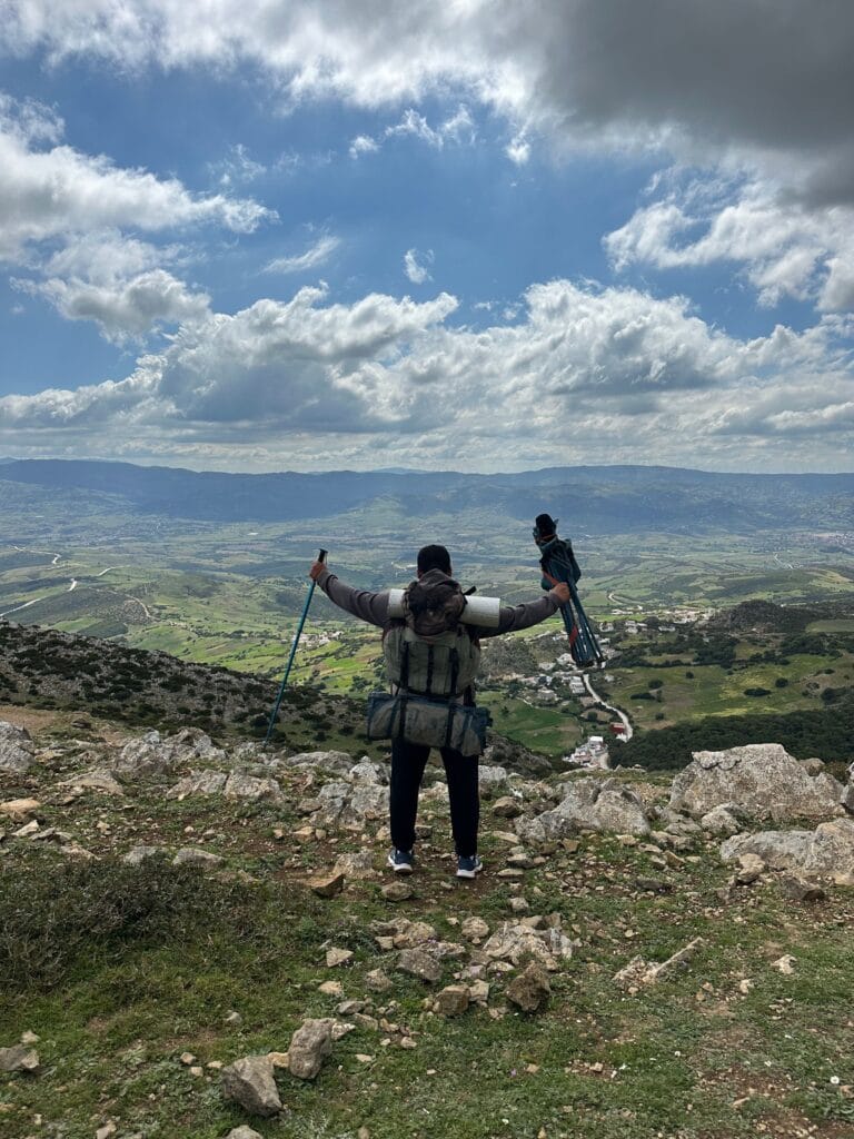
Hiking in the Middle Atlas Mountain
The Middle Atlas offers a different hiking experience from the High Atlas.
You should not necessarily come expecting extreme summit climbing.
Instead, the region is particularly suited to:
- forest walks;
- lake excursions;
- plateau hiking;
- valley exploration;
- geological observation;
- birdwatching;
- wildlife observation;
- rural trekking;
- and cultural landscape walks.
The diversity of terrain means that hiking can be combined with anthropology and environmental observation.
A walk through a cedar forest, for example, can become an opportunity to understand:
- forest ecology;
- pastoral practices;
- wildlife;
- climate;
- traditional resource use;
- and tourism pressures.
Middle Atlas Compared With the High Atlas
The two mountain regions belong to the same broader Atlas system, but their geographical characters are substantially different.
| Feature | Middle Atlas | High Atlas |
|---|---|---|
| Dominant landscape | Plateaus, forests, lakes, folded mountains | High peaks, valleys, alpine landscapes |
| Famous ecosystem | Atlas cedar forests | High-elevation mountain ecosystems |
| Volcanic features | Particularly significant | Present in some areas but less defining |
| Karst landscapes | Extensive | Also present |
| Major cultural context | Central Atlas Amazigh communities | Numerous High Atlas Amazigh communities |
| Pastoralism | Important | Important |
| Hiking character | Forest, plateau, lake and valley trekking | High-mountain trekking and summit routes |
| Water landscapes | Springs, lakes and karst systems | Springs, rivers, snowmelt and high valleys |
| Highest-profile city | Ifrane/Azrou region | Marrakech/High Atlas gateways and mountain towns |
| Visual character | Forested and spacious | Dramatic and rugged |
The comparison is useful precisely because it demonstrates why the Middle Atlas deserves its own dedicated study rather than being treated as a minor subsection of a general Atlas article.
Middle Atlas Mountain vs Anti-Atlas montain
The contrast becomes even more pronounced when the Middle Atlas is compared with the Anti-Atlas.
| Feature | Middle Atlas Montain | Anti-Atlas Montain |
|---|---|---|
| Climate | Cooler and more varied | Generally more arid |
| Forests | Major cedar forests | Argan, juniper and arid vegetation in different zones |
| Water | Lakes, springs and karst groundwater | Oases, seasonal rivers and groundwater systems |
| Geology | Limestone, volcanic and folded formations | Very ancient geological formations |
| Cultural landscapes | Pastoral and forest communities | Oases, agadir granaries, dryland agriculture |
| Tourism | Forests, lakes, hiking | Geological landscapes, oases and cultural heritage |
These differences are important for your site’s topical architecture.
Your Atlas Mountains pillar should explain these broad distinctions.
The individual cluster articles should then investigate them in depth.
The Middle Atlas and Its Neighboring Regions
The Middle Atlas Mountain does not exist in isolation.
Its northern landscapes connect with the Saïs and Rif-related regions.
Its southern and southeastern areas interact geographically with the High Atlas and High Moulouya.
Its eastern landscapes approach the broader Moulouya basin and eastern Moroccan environments.
This geographical position has historically made the Middle Atlas a transition zone.
It is simultaneously:
mountain and plateau, forest and pasture, northern and interior, humid and semi-arid.
That transitional quality is one of the keys to understanding its diversity.
The Future of the Middle Atlas
The Middle Atlas Mountain now faces a complex set of challenges.
Climate change is likely to increase pressure on water resources and forest ecosystems.
Drought can affect:
- pasture;
- agriculture;
- springs;
- lakes;
- forest regeneration;
- and livestock.
Tourism can provide income but can also increase environmental pressure.
Urbanization can create new economic opportunities while weakening some traditional forms of land use.
Migration can reduce the number of young people participating directly in pastoral and agricultural livelihoods.
Digital media, meanwhile, can either accelerate cultural erosion or become a powerful tool for cultural preservation.
The future will depend partly on whether modernization is treated as the enemy of tradition—or as a possible partner in its survival.
Preserving the Middle Atlas as a Living Culture
Preservation should not mean freezing communities in the past.
A living culture must be allowed to change.
The objective should instead be to preserve the knowledge systems, languages, ecological practices, artistic traditions, historical memory, and community institutions that communities themselves consider meaningful.
This may include:
- documenting Central Atlas Tamazight;
- recording oral histories;
- supporting traditional artisans;
- protecting cedar ecosystems;
- studying traditional water management;
- documenting pastoral routes;
- supporting responsible tourism;
- preserving historic rural architecture;
- digitizing photographs and manuscripts;
- and encouraging young people to participate in heritage research.
Heritage becomes stronger when local people become its interpreters rather than merely its subjects.
Why the Middle Atlas Mountain Matters to Morocco
The Middle Atlas Mountain is important not because it contains one spectacular monument.
Its significance lies in the relationship between many things.
A forest.
A spring.
A lake.
A village.
A carpet.
A pastoral route.
A language.
A mountain.
A market.
A story.
Each one becomes more meaningful when viewed as part of the larger system.
The Middle Atlas demonstrates that cultural heritage does not always exist inside museums.
Sometimes it exists in landscapes.
Sometimes it survives in words.
Sometimes it is woven into wool.
Sometimes it is carried through a song.
Sometimes it is transmitted while walking behind a flock across a mountain pasture.
FAQ: Middle Atlas Mountain
What is the Middle Atlas Mountain region?
The Middle Atlas is a major mountain region of central Morocco characterized by limestone plateaus, folded mountain structures, cedar forests, volcanic landscapes, lakes, springs, pastoral areas, and Amazigh communities.
Where is the Middle Atlas Mountain located?
The Middle Atlas extends broadly across central Morocco between the northern Moroccan plains and the High Atlas–High Moulouya region. It includes landscapes around Ifrane, Azrou, Boulemane, Khenifra and surrounding mountain areas.
What is the Middle Atlas Mountain famous for?
The Middle Atlas Mountain is particularly famous for its Atlas cedar forests, mountain lakes, volcanic landscapes, karst formations, pastoral traditions, Amazigh culture, carpets, wildlife, and scenic hiking routes.
Are the Middle Atlas Mountains Amazigh?
Many communities throughout the Middle Atlas Mountain have deep Amazigh historical and cultural roots, and Central Atlas Tamazight is an important Amazigh language of the region. However, the Middle Atlas contains diverse communities and should not be treated as culturally uniform.
What languages are spoken in the Middle Atlas Mountain?
Moroccan Arabic and Amazigh varieties are spoken across the region. Central Atlas Tamazight is particularly important in many Middle Atlas communities.
What are the Middle Atlas Mountain carpets known for?
Middle Atlas carpets are known for their wool, geometric compositions, regional variation, distinctive colors and handmade production. Their designs should be interpreted carefully because meanings vary between communities and historical contexts.
Can you hike in the Middle Atlas?
Yes. The Middle Atlas offers forest walks, lake hikes, plateau trekking, rural routes and mountain excursions. It generally provides a different experience from the more extreme high-altitude trekking associated with the High Atlas.
What animals live in the Middle Atlas?
The region supports diverse wildlife, including the Barbary macaque and numerous bird species, alongside other mammals and forest organisms.
What is special about the cedar forests of the Middle Atlas?
The cedar forests form one of Morocco’s most distinctive mountain ecosystems. They provide habitat for wildlife, contribute to water and soil systems, and have historically been important to local communities.
Is the Middle Atlas different from the High Atlas?
Yes. The Middle Atlas Mountain is generally characterized more strongly by plateaus, cedar forests, lakes, karst systems and volcanic landscapes, while the High Atlas is better known for its much higher peaks, dramatic valleys and alpine environments.
Conclusion: The Middle Atlas Mountain Is a Landscape That Remembers
The Middle Atlas Mountains cannot be reduced to a collection of beautiful photographs.
Its cedar forests tell an ecological story.
Its volcanic rocks preserve geological memories.
Its lakes contain environmental archives.
Its springs reveal the hidden movement of groundwater.
Its villages preserve architectural adaptations.
Its carpets carry artistic traditions.
Its pastoral routes preserve knowledge of seasonal landscapes.
Its languages transmit memory.
And its people continue to negotiate the relationship between inherited traditions and a rapidly changing Morocco.
This is what makes the Middle Atlas Mountain so important.
It is not simply one of Morocco’s mountain ranges.
It is a meeting point between nature and society, geology and memory, language and landscape, tradition and modernity.
For travelers, the region offers forests, lakes, villages and extraordinary scenery.
For researchers, it provides an exceptional laboratory for studying geology, climate, archaeology, anthropology and cultural continuity.
For Amazigh communities, it remains part of a much deeper cultural geography in which mountains are not merely physical features but territories shaped by generations of human experience.
And for Morocco itself, the Middle Atlas represents an important part of the country’s environmental and cultural diversity.
To walk through its forests, cross its plateaus, sit beside one of its lakes, visit its markets, listen to its languages, or encounter its traditional crafts is to encounter something larger than a destination.
It is to encounter a landscape in which memory has been woven into the mountains themselves.
The future of the Middle Atlas will depend on whether Morocco can protect its ecosystems while allowing its communities to remain active participants in shaping their own cultural future.
Because heritage survives not when it is placed behind glass, but when people continue to speak it, make it, practice it, adapt it, and pass it forward.
And perhaps that is the deepest lesson of the Middle Atlas:
a mountain becomes cultural heritage not simply because it has endured for thousands of years, but because generation after generation continues to find meaning in living beside it.
References — APA Style
- Babault, J., Teixell, A., Arboleya, M.-L., & Charroud, M. (2008). A late Cenozoic age for long-wavelength topography development in the Atlas Mountains of Morocco. Earth and Planetary Science Letters, 270(1–2), 102–113.
- Beauchamp, W., Barazangi, M., Demnati, A., & Alami, S. O. (1999). Rifting and inversion in the Atlas Mountains of Morocco. Tectonics, 18(3), 520–536.
- Charrière, A. (1990). Le Moyen Atlas central: Stratigraphie, paléogéographie et tectonique. Université scientifique et médicale de Grenoble.
- Camps, G. (1980). Berbères: Aux marges de l’histoire. Éditions des Hespérides.
- Ennaji, M. (2005). Multilingualism, cultural identity, and education in Morocco. Springer.
- Hoffman, K. E. (2008). We share walls: Language, land, and gender in Berber Morocco. Wiley-Blackwell.
- Laville, E., & Piqué, A. (1991). La distension crustale et les déformations atlasiques au Maroc. Bulletin de la Société Géologique de France.
- Naouadir, I., Adil, S., Chellai, E. H., Ettaki, M., Elaaraj, A., Alitane, A., Parise, M., & Veress, M. (2025). Analysis of karst factors and paleoenvironmental significance of endo- and exokarst landforms in the Middle Atlas of Morocco. Proceedings of the Geologists’ Association, 136(6), 101137.
- Pastor, A., Babault, J., Owen, L. A., & Arboleya, M.-L. (2015). Extracting dynamic topography from river profiles and cosmogenic nuclide geochronology in the Middle Atlas and the High Plateaus of Morocco. Tectonophysics, 663, 95–109.
- Teixell, A., Arboleya, M.-L., Charroud, M., & Julivert, M. (2003). Tectonic shortening and topography in the central High Atlas and Middle Atlas of Morocco. Tectonics.


3 Comments